

From Easy Nature Walks to Bucket-List Mountain Adventures

Best Hiking Trails in the Great Smoky Mountains: The Ultimate Guide for Every Skill Level
One of my favorite Smoky Mountain mornings began before the sun had fully reached the valleys below Newfound Gap. The parking area was quiet except for the soft sound of hiking boots on pavement and the occasional click of trekking poles being adjusted. As the first light filtered through the ridges, the heavy fog slowly pulled away from the mountains like a curtain, revealing layer upon layer of blue-green peaks stretching toward the horizon. It’s a scene I’ve experienced on more than one visit, yet it never feels routine. Those peaceful early hours remind me why I keep returning to the Great Smoky Mountains—not just for the scenery, but for the chance to slow down and experience the park on its own terms before the day grows busy.
Hiking reveals a side of the Smokies that you simply can’t appreciate from behind a windshield. Scenic drives offer unforgettable overlooks, but trails take you into places that most visitors never experience: ancient hardwood forests where spring wildflowers blanket the forest floor, cool stream valleys carved over thousands of years, geologic landmarks like Arch Rock, and high-elevation spruce-fir forests that feel remarkably different from the valleys below. Some mornings you’ll hear little more than rushing water and birdsong. On others, shifting mountain fog creates entirely different landscapes from one overlook to the next. Whether you’re standing beneath a waterfall after an early morning hike or reaching an overlook like Cliff Tops after a challenging climb toward Mount LeConte, every trail reveals another side of these mountains. If you’re still planning the bigger picture of your visit, Great Smoky Mountains National Park: The Complete Visitor Guide provides a helpful overview of the park’s entrances, visitor centers, scenic drives, and trip-planning essentials before you decide which hikes best fit your itinerary.
This guide is designed for travelers who want practical advice rather than a long list of trail names. If this is your first visit, I’ll help you choose hikes that showcase the park’s incredible variety without leaving you completely exhausted. Families will find walks that balance memorable scenery with realistic expectations for younger hikers, while experienced hikers can compare some of the park’s most rewarding all-day adventures. Waterfall lovers, photographers hoping to catch the soft morning light, and backpackers looking for longer routes will also find guidance based on how these trails actually feel throughout the seasons—not simply what appears on a trail map.
You’ll also find important updates that many older travel guides and websites still overlook. For example, the popular Laurel Falls Trail has been undergoing a major rehabilitation project that began in 2025, making it essential to check its current status before building your itinerary. Throughout this guide, I’ll also use the official Cherokee name Kuwohi while noting that many visitors still know it by its former name, Clingmans Dome. Understanding both names will make it easier to follow current park signage while recognizing older maps, guidebooks, and online recommendations.
Rather than trying to catalog all 800 miles of maintained trails inside the national park, I’ve focused on the hikes that consistently provide the most rewarding experiences for a wide variety of travelers. Just as importantly, I’ll share the practical details that often make the difference between a memorable day and a frustrating one—when arriving thirty minutes earlier can save an hour of waiting for a parking space, why the park’s Park It Forward parking tag should be purchased before heading into areas with unreliable cell service, and which trails are worth adjusting your schedule to experience in the quiet light of early morning. My goal is simple: help you spend less time sorting through conflicting recommendations online and more time enjoying the peaceful forests, rushing streams, mountain vistas, and unforgettable moments that make hiking in the Great Smoky Mountains one of the finest outdoor experiences in the eastern United States.
Best Hiking Trails in the Great Smoky Mountains at a Glance
Choosing the best hiking trails in the Great Smoky Mountains isn’t about finding the single “best” hike—it’s about finding the trail that best matches your interests, fitness level, available time, and where you’re staying. One lesson I’ve learned after returning to the Smokies year after year is that the right trail on the right day almost always creates a better memory than tackling the park’s most famous hike simply because it’s on every must-do list. A challenging climb like Charlies Bunion is incredibly rewarding when you arrive at Newfound Gap before sunrise. The same hike can feel far less enjoyable if your morning begins sitting in traffic and searching for a parking space.
Location matters just as much as difficulty. The Great Smoky Mountains National Park covers more than half a million acres, and trailheads are spread across several different areas of the park. While Rainbow Falls and Alum Cave Trail are both convenient from Gatlinburg, Deep Creek is reached from Bryson City, North Carolina, making it a completely different day trip. Likewise, Abrams Falls sits deep inside Cades Cove, where traffic patterns can significantly affect how long it takes to reach the trailhead. Understanding where each hike begins will help you spend more time on the trail and less time behind the wheel.
Before planning any hike, remember that vehicles parked inside Great Smoky Mountains National Park for more than 15 minutes require a valid Park It Forward parking tag. Daily, weekly, and annual tags are available, but they must be properly displayed in your vehicle. It’s also worth remembering that many trailheads have little or no reliable cell service, so purchasing or printing your parking tag before entering the park is one less thing to worry about on the morning of your hike.
Finally, always verify current trail conditions before you leave for the park. Conditions can change because of weather, maintenance projects, or temporary closures. A good example is Laurel Falls Trail, which entered a major rehabilitation project beginning in 2025. While it has long been one of the park’s most popular family hikes, visitors should confirm that it has officially reopened before including it in their itinerary.
| Trail | Trailhead / Area | Round Trip Distance | Elevation Gain | Difficulty | Typical Hiking Time | Best Season | Best For | Parking Reality |
| Laurel Falls* | Fighting Creek Gap Road | 2.6 miles | 314 ft | Easy | 1–2 hours | Spring, Fall | Families, first-time visitors | Check current trail status before visiting due to rehabilitation work. |
| Alum Cave Trail | Newfound Gap Road (US-441) | 4.6 miles | 1,125 ft | Moderate | 3–5 hours | Spring, Fall | Scenic hiking, geology, photographers | Very limited parking. Sunrise arrival is strongly recommended during busy seasons. |
| Chimney Tops** | Newfound Gap Road (US-441) | 3.8 miles | 1,300 ft | Strenuous | 2–4 hours | Spring, Fall | Experienced hikers, dramatic views | Parking fills very quickly, especially on weekends. |
| Rainbow Falls | Cherokee Orchard / Roaring Fork area | 5.4 miles | 1,500 ft | Moderate to Strenuous | 3–5 hours | Spring, Winter | Waterfall lovers | Arrive early before Roaring Fork traffic increases. |
| Andrews Bald | Kuwohi Road | 3.6 miles | 900 ft | Moderate | 2–3 hours | Summer, Fall | Wildflowers, panoramic views | Moderate parking demand when Kuwohi Road is open. |
| Charlies Bunion | Newfound Gap | 8.0 miles | 1,600 ft | Moderate to Strenuous | 4–6 hours | Spring, Fall | Ridge hiking, experienced hikers | Newfound Gap parking often reaches capacity early. |
| Abrams Falls | Cades Cove Loop Road | 5.0 miles | 650 ft | Moderate | 3–4 hours | Spring, Summer | Waterfalls, families with older children | Cades Cove traffic can greatly affect travel time. |
| Mount LeConte via Alum Cave | Newfound Gap Road | 11.0 miles | 2,760 ft | Strenuous | 6–8 hours | Late Spring through Fall | Bucket-list hikers | Plan on arriving before dawn during peak seasons. |
| Kuwohi Observation Tower Trail (formerly Clingmans Dome) | Kuwohi Road | 1.2 miles | 330 ft | Moderate (very steep paved climb) | 45–60 minutes | Summer, Fall | Scenic overlooks | Short trail but steep enough to challenge many visitors because of the elevation. |
| Ramsey Cascades | Greenbrier | 8.0 miles | 2,200 ft | Strenuous | 5–7 hours | Spring, Fall | Experienced hikers | Moderate parking demand with a quieter setting than Newfound Gap. |
| Gregory Bald | Cades Cove / Forge Creek Road | 11.6 miles | 3,000 ft | Strenuous | 6–8 hours | Late June, Fall | Serious hikers, flame azaleas | Requires a full-day commitment. |
| Deep Creek Loop | Bryson City, North Carolina | 2–5+ miles | Minimal to Moderate | Easy to Moderate | 1–3 hours | Spring, Summer, Fall | Families, waterfalls, tubing | Best planned as a separate day from Gatlinburg because of the drive. |
Parking & Planning Notes
Very High Parking Demand: Alum Cave Trail, Chimney Tops, Mount LeConte, and Charlies Bunion all begin along the Newfound Gap Road corridor, one of the busiest areas of the national park. During spring wildflower season, October’s fall colors, and many summer weekends, arriving around sunrise provides the best chance of parking at the trailhead. Waiting until mid-morning often means spending valuable hiking time searching for a space.
High Parking Demand: Rainbow Falls also fills quickly, particularly once visitors begin driving the Roaring Fork Motor Nature Trail. An early start not only improves parking but usually rewards hikers with cooler temperatures and softer light filtering through the forest.
Moderate Parking Demand: Andrews Bald, Ramsey Cascades, Gregory Bald, and Deep Creek generally provide a less hectic start to the day, although holiday weekends and peak fall foliage can still increase visitor numbers.
Important Trail Notes
- Laurel Falls Trail: This long-popular family hike entered a major rehabilitation project beginning in 2025. Before planning your visit, verify that the trail has officially reopened.
- Chimney Tops Trail: The hike now ends at the observation platform. The iconic rock pinnacle beyond the platform has remained permanently closed since the 2016 wildfires for visitor safety.
- Kuwohi Observation Tower Trail: Although the walk is only about 1.2 miles round trip, don’t underestimate it. The paved path climbs at a steep grade above 6,600 feet in elevation. Families with strollers, visitors with limited mobility, or anyone sensitive to higher elevations may find this short hike surprisingly strenuous.
- Abrams Falls: If you’re planning to hike on a Wednesday between early May and late September, remember that Cades Cove operates vehicle-free Wednesdays during that period. That creates a wonderful experience for cyclists and walkers but changes how you’ll reach the Abrams Falls trailhead.
This table is meant to narrow your choices, not overwhelm you. As you continue through this guide, we’ll take a closer look at each trail so you can decide not only which hike is the most scenic, but which one best matches your travel style, available time, and expectations for your visit to the Great Smoky Mountains.
How to Choose the Right Smoky Mountain Hike
One of the best lessons the Great Smoky Mountains has taught me is that the “perfect” hike doesn’t exist. The right hike is the one that matches your interests, your fitness level, the season, and how you want to spend your day. I’ve watched visitors wear themselves out trying to conquer the park’s most famous trails before lunch, only to skip scenic overlooks, local restaurants, or an evening stroll through Gatlinburg because they simply had nothing left in the tank. On the other hand, I’ve met travelers who chose a shorter trail, lingered beside a mountain stream, enjoyed a relaxed dinner afterward, and left convinced they’d experienced the Smokies exactly as they hoped.
Before choosing a trail, think beyond mileage. Ask yourself what you actually want from the experience. Are you hoping to photograph a sunrise from a mountain ridge? Do you want to hear rushing water beside a forest trail? Are you traveling with children who would rather discover salamanders than climb switchbacks for hours? The answers to those questions usually matter far more than whether a hike appears on someone’s “Top 10” list.
Easy Hikes
Easy hikes are perfect for first-time visitors, families with younger children, anyone returning to hiking after a break, or travelers who simply want to enjoy the mountains without committing an entire day to the trail. These walks provide rewarding scenery while leaving plenty of time to explore Gatlinburg, enjoy a scenic drive, or stop for lunch without feeling rushed.
One of my favorite beginner recommendations is Cataract Falls, tucked quietly behind Sugarlands Visitor Center. At less than a mile round trip on an easy path, it offers many of the sights people come to the Smokies hoping to find: towering trees, rushing water, moss-covered rocks, and a picturesque waterfall. Because many visitors head straight toward the larger trailheads, Cataract Falls often feels surprisingly peaceful, especially early in the morning. It’s also an excellent introduction to hiking for young children who may not be ready for steeper climbs.
Another excellent option is the Kuwohi Observation Tower Trail (formerly Clingmans Dome). Although the hike is only about 1.2 miles round trip, don’t mistake short for easy. The paved path climbs at a steep grade to more than 6,600 feet above sea level, and the elevation catches many visitors by surprise. I’ve experienced afternoons when it was warm enough for short sleeves in Gatlinburg while the summit was wrapped in cold fog with strong winds. Even during summer, I almost always carry a lightweight jacket for the climb. Families with older children usually enjoy the experience, but anyone pushing a stroller or dealing with heart or breathing conditions should plan for frequent breaks.
Important Update: Laurel Falls Trail entered a major rehabilitation project beginning in 2025 and remains unavailable until the National Park Service officially reopens it. If Laurel Falls is still closed during your visit, Cataract Falls provides one of the best easy alternatives near Gatlinburg.
Moderate Hikes
Moderate hikes are where many visitors discover the Smokies at their best. These trails require a little more effort than the park’s easiest walks, but the rewards usually include quieter forests, larger waterfalls, and panoramic views that feel genuinely earned without demanding the endurance of an all-day mountain climb.
Andrews Bald is one of the easiest hikes to recommend for travelers looking for expansive scenery. After a steady climb, the trail opens onto one of the park’s beautiful grassy balds. If you visit in late June or early July, the famous Catawba rhododendrons transform the landscape into a sea of pink and purple blooms. Outside bloom season, the open views alone make the effort worthwhile, particularly during the softer light of early morning or late afternoon.
Rainbow Falls appeals to hikers who don’t mind a steady uphill walk in exchange for one of the park’s best-known waterfalls. The trail follows LeConte Creek through mature forest before arriving at the impressive 80-foot cascade. During winter, ice often forms around the falls, while spring usually brings the strongest water flow. If photography is your goal, overcast mornings often produce the best images by reducing harsh shadows and bright reflections on wet rock.
The Deep Creek trail system offers something different. Located near Bryson City, North Carolina, rather than Gatlinburg, it combines several easy-to-moderate trails that can be mixed into a hike that fits your schedule. Because reaching Deep Creek requires crossing the mountains from Tennessee into North Carolina, I recommend making it the primary destination for the day rather than trying to combine it with hikes near Newfound Gap or Roaring Fork.
Challenging Hikes
The Smokies reserve some of their most unforgettable experiences for hikers willing to invest the time and effort. Challenging hikes aren’t about proving anything—they’re about reaching places that relatively few visitors experience.
Mount LeConte via Alum Cave Trail remains one of the signature hikes in Great Smoky Mountains National Park. One of the things I appreciate most about this trail is how dramatically the landscape changes as you climb. The lower forest feels humid and rich with hardwoods before gradually giving way to cooler spruce-fir forest near the summit. Passing through Arch Rock, standing beneath Alum Cave Bluffs, and finally reaching LeConte’s lofty viewpoints creates the feeling of hiking through several different parks in a single day.
Ramsey Cascades is another hike that rewards preparation. The climb is long, the elevation gain is significant, and the footing becomes more challenging near the end, but the destination is the tallest waterfall in the national park. This isn’t the trail I’d recommend simply because it’s famous. It’s best suited for hikers who genuinely enjoy spending an entire day immersed in the forest.
Gregory Bald offers a different reward. Instead of chasing waterfalls, you’ll climb toward broad mountain views and, during late June and early July, one of the most remarkable displays of rare flame azaleas anywhere in the Appalachians. Their colors range from pale yellow to brilliant orange and deep red, making this one of the Smokies’ most celebrated wildflower destinations.
Best Hikes for Families
Families usually enjoy hikes that provide frequent rewards along the way rather than saving everything for the finish. Children tend to stay engaged when there’s a creek to explore, bridges to cross, or something interesting around the next bend.
While Laurel Falls has traditionally filled that role, Cataract Falls currently makes one of the best family-friendly alternatives near Gatlinburg. The trail is short enough for most young hikers while still delivering a satisfying waterfall destination.
The Kuwohi Observation Tower Trail works well for many families with older children, provided everyone understands that the short climb is surprisingly steep. Meanwhile, the Deep Creek area is ideal for families spending time on the North Carolina side of the park because multiple short trails, waterfalls, and creekside scenery can easily fill a relaxed morning or afternoon.
Best Hikes for Photographers
Photography in the Smokies is all about light. The mountains rarely look their best under harsh midday sunshine. Instead, the first few hours after sunrise often reveal the layered blue ridges that gave the Smokies their name, while late afternoon produces warm light across the valleys and overlooks.
Mountain photographers will find outstanding opportunities on Charlies Bunion, Mount LeConte, Andrews Bald, and Kuwohi. Waterfall photographers should pay close attention to the weather forecast. Cloudy days are often better than sunny ones because soft light reduces glare on wet rocks and keeps the forest evenly illuminated.
If photographing waterfalls is your priority, Grotto Falls deserves special attention. It’s one of the few waterfalls in the park where visitors can safely walk behind the curtain of falling water. The natural rock overhang creates ideal lighting for long-exposure photography, even when brighter skies would normally make photographing waterfalls more difficult.
Best Hikes for Waterfalls
The Smokies receive abundant rainfall throughout the year, feeding hundreds of mountain streams and creating some of the most beautiful waterfalls in the eastern United States. Rather than thinking about waterfall hikes as one interchangeable group, it helps to choose them by location.
Near Gatlinburg, Rainbow Falls and Grotto Falls are both excellent choices. Rainbow Falls rewards hikers with one of the park’s tallest single-drop waterfalls, while Grotto Falls offers the rare opportunity to walk behind the cascading water.
In Cades Cove, Abrams Falls remains the area’s signature waterfall hike. Although the waterfall is shorter than many visitors expect, its tremendous volume of water and powerful current make it especially impressive after periods of rain. Keep in mind that reaching the trailhead requires driving the Cades Cove Loop Road, and from early May through late September, Wednesdays are reserved for pedestrians and cyclists rather than motor vehicles.
Near Bryson City, the Deep Creek trail system provides access to several waterfalls within a relatively short distance, making it an excellent option for visitors exploring the North Carolina side of the park.
Best Hikes for Panoramic Views
If sweeping mountain vistas are your priority, several trails consistently stand above the rest.
Charlies Bunion offers one of the finest ridge-top viewpoints in the national park and rewards hikers with expansive Appalachian scenery after a rewarding trek along the Appalachian Trail.
Andrews Bald combines moderate effort with broad open views, making it an excellent choice for visitors seeking impressive scenery without committing to an all-day climb.
Mount LeConte provides several spectacular overlooks, including Cliff Tops and Myrtle Point, where the sense of elevation becomes part of the experience itself.
Finally, Kuwohi delivers perhaps the easiest access to one of the highest viewpoints in the eastern United States. On clear mornings, the observation tower offers seemingly endless mountain ridges stretching toward the horizon. On foggy days, patience often pays off. I’ve stood on the tower watching clouds drift past until the mountains suddenly appeared for just a few unforgettable minutes before disappearing again.
The Smokies aren’t a place to rush through. Rather than trying to check off three or four famous hikes in a single day, choose one trail that genuinely matches your interests and give yourself time to enjoy it. Some of my favorite memories have come from sitting quietly beside a creek or lingering at an overlook long after everyone else had continued down the trail. Those unhurried moments are often what bring me back year after year.
Planning More Than One Hiking Day?
If you’re planning several days of hiking, where you stay can make a noticeable difference. Lodging near the Sugarlands entrance provides quick access to Newfound Gap Road, while accommodations closer to the eastern side of Gatlinburg can make early departures toward Roaring Fork more convenient. Reducing your morning drive often means arriving before parking lots fill, enjoying cooler temperatures on the trail, and spending more of your day exploring instead of waiting in traffic. Before finalizing your itinerary, explore Where to Stay in Gatlinburg to find the best base camp for the hikes you want to experience.

Bearskin Lodge on the River
Tucked near the entrance of Great Smoky Mountains National Park and just minutes from the Gatlinburg Convention Center and Space Needle, Bearskin Lodge on the River offers a cozy, nature-inspired retreat with modern comforts. Guests can relax by the firepit, enjoy a workout in the gym, or float the day away in the seasonal outdoor pool featuring a lazy river. Complimentary perks include free self-parking, in-room WiFi, and coffee or tea in the inviting lobby. Each of the 96 rooms is designed for comfort with premium bedding, air conditioning, flat-screen TVs, and convenient extras like refrigerators, microwaves, and coffee makers. With helpful staff, tour assistance, and a location that blends peaceful riverside views with downtown access, Bearskin Lodge is a favorite for travelers looking to experience the Smokies in style and comfort.
Check Availability
Courtyard by Marriott Gatlinburg Downtown
Set just off the Parkway on Airport Road, Courtyard by Marriott Gatlinburg Downtown offers a modern, convenient base for travelers who want to explore downtown Gatlinburg largely on foot. The hotel features contemporary rooms and suites, including balcony options, along with an indoor swimming pool, outdoor hot tub, fire pit, fitness center, and The Bistro for breakfast, evening meals, and drinks. Its location is particularly convenient for the Gatlinburg Convention Center and provides walkable access to restaurants, shops, the Space Needle, Ober Mountain Aerial Tramway, and many downtown attractions. On-site self-parking currently costs $15 per day, and breakfast is not complimentary, so both should be considered when comparing the total cost with nearby hotels. Courtyard also offers less Smoky Mountain character than Gatlinburg’s historic, riverfront, and resort-style properties. With its combination of modern accommodations, useful indoor amenities, Marriott Bonvoy participation, and downtown walkability, Courtyard is especially well suited to families, couples, convention visitors, and first-time travelers who want the hotel to serve as a comfortable base for exploring Gatlinburg and Great Smoky Mountains National Park.
Check Availablity
Fairfield Inn & Suites by Marriott Gatlinburg Downtown
Just steps from Ripley’s Aquarium of the Smokies, Gatlinburg Convention Center, and the Space Needle, Fairfield Inn & Suites by Marriott Gatlinburg Downtown offers a bright and modern stay in the heart of the action. Guests can enjoy a complimentary continental breakfast each morning, relax in the seasonal outdoor pool or hot tub, and unwind on the terrace or by the lobby fireplace. The hotel also features a fitness center, luggage storage, and convenient dry cleaning services. All 98 guest rooms come with premium bedding, air conditioning, free WiFi, and thoughtful extras like refrigerators, microwaves, and 50-inch LED TVs. Families will appreciate free infant and extra beds, while eco-conscious guests can take comfort in the use of LED lighting and recycling amenities. With rave reviews for its clean rooms, friendly staff, and walkable location, this Marriott property is a standout choice for your next Smoky Mountain getaway.
Buy Now
Gatlinburg River Inn
Just steps from Anakeesta, Ripley’s Aquarium of the Smokies, and SkyPark, Gatlinburg River Inn offers a relaxing stay with thoughtful amenities and scenic comfort. Guests enjoy a complimentary continental breakfast each morning, along with access to a seasonal outdoor pool, children’s pool, and a riverside terrace complete with firepit and hot tub for winding down after a day of exploring. Free in-room WiFi, self-parking, and laundry facilities make your stay even more convenient. The 58 guest rooms feature balconies, mini-fridges, microwaves, and air conditioning, with clean, comfortable spaces that reviewers consistently praise. With a 24-hour front desk, vending machines, and a smoke-free setting, Gatlinburg River Inn is a well-rounded choice for both families and couples looking to stay close to the action in downtown Gatlinburg.
Buy Now
Gatlinburg Town Square By Exploria Resort
Gatlinburg Town Square by Exploria Resorts places you right where the action is, just a short 10-minute stroll from top attractions like the Gatlinburg Convention Center and the Space Needle. Whether you’re looking to stay active at the fitness center or make a splash in the indoor or seasonal outdoor pools, this eco-certified resort has you covered. Kids will love their own dedicated pool, while adults can relax and unwind in the hot tub. Guests frequently rave about the welcoming staff and prime location.
Buy Now
Hampton Inn Gatlinburg Historic Nature Trail
Set just uphill from downtown on Historic Nature Trail, Hampton Inn Gatlinburg Historic Nature Trail offers a quieter base while keeping the Parkway within walking distance. The recently renovated hotel includes complimentary hot breakfast, free Wi-Fi, a heated indoor pool, connecting rooms, pet-friendly accommodations, EV charging, and a relaxing outdoor fire-pit area. A Gatlinburg Trolley stop is right outside, while the Convention Center and W.L. Mills Conference Center are nearby. Self-parking currently costs $15 per day. It is best suited to families, couples, convention visitors, and travelers who want convenient access to both downtown Gatlinburg and Great Smoky Mountains National Park without staying directly on the Parkway.
Check Availability Now
Hilton Garden Inn Gatlinburg
This pet-friendly, smoke-free hotel features free WiFi, an indoor pool and hot tub, on-site dining at the Garden Grille with a bar and happy hour, a fitness center, family-friendly amenities like in-room microwaves and refrigerators, free parking (including accessible options), cooked-to-order breakfast, a business center with over 1,100 sq ft of meeting space, laundry facilities, and convenient access to golf, tennis, hiking, and skiing, all in a five-story building built in 2009 with extensive accessibility features throughout.
Book Now
Historic Rocky Waters Inn
Newly remodeled in 2024, Historic Rocky Waters Inn, A Small Luxury Hotel offers upscale comfort just steps from Ripley’s Aquarium of the Smokies, Anakeesta, and SkyPark. This boutique retreat blends modern elegance with Gatlinburg charm, featuring a scenic terrace, outdoor entertainment space, and a cozy bar. Guests can enjoy breakfast or dinner at the on-site restaurant, The Heirloom Room, and stay connected with free in-room WiFi. Additional perks include free self-parking, concierge service, and express check-in/check-out for added convenience. Each guestroom is thoughtfully designed with premium bedding, air conditioning, and bathrobes, plus modern touches like 50-inch flat-screen TVs, workspaces, and balconies. With glowing reviews for its walkable location and attentive service, this small luxury stay is perfect for travelers seeking both style and substance in the Smokies.
Check Availability
Margaritaville Resort
Conveniently situated in the Gatlinburg part of Gatlinburg (TN), this property puts you close to attractions and interesting dining options. This 4-star property is packed with in-house facilities to improve the quality and joy of your stay.
Buy Now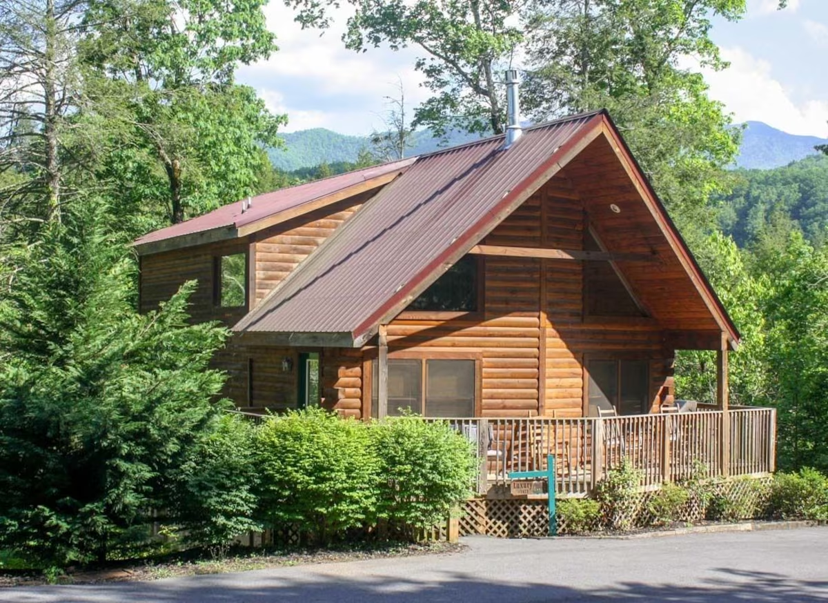
Mountain Shadow Resort & Rentals
Experience rustic luxury in the heart of the Smokies at Mountain Shadows Resort Rentals, where charming log cabins meet modern convenience. Whether you're planning a romantic honeymoon or a lively family reunion, this resort offers spacious accommodations complete with hot tubs, fireplaces, fully equipped kitchens, game rooms, and even gas/electric grills for cookouts under the stars. Guests can enjoy on-site amenities like a seasonal swimming pool, children’s playground, free high-speed WiFi, and pet-friendly options—making it easy for everyone to feel at home. Nestled adjacent to the Great Smoky Mountains National Park and conveniently located near the Gatlinburg trolley line, you're never far from scenic hikes, mountain views, and local attractions. While the resort holds an average rating of 3.1, many guests appreciate its peaceful setting and unique log-home atmosphere. With family rooms, non-smoking options, and features like whirlpool tubs and fireplaces, Mountain Shadows Resort invites you to unwind, explore, and make lasting memories in one of Gatlinburg’s most scenic spots.
Buy Now
River Edge Inn
Conveniently located near the Gatlinburg Convention Center, Gatlinburg Space Needle, and Ripley's Believe It or Not Museum, River Edge Inn offers a welcoming stay just steps from the action. Guests can start their day with a complimentary to-go breakfast, relax on the terrace, or unwind by the cozy lobby fireplace. The hotel features a seasonal outdoor pool and children’s pool with sun loungers, as well as a snack bar/deli, free self-parking, and high-speed in-room WiFi (50+ Mbps). Each guestroom is equipped with premium bedding, air conditioning, a private balcony, and essentials like a microwave, refrigerator, and 32-inch TV with premium channels. Families will appreciate extras like hypoallergenic bedding and available cribs, while guest reviews consistently praise the helpful staff and clean, comfortable rooms. Whether you're here for business or a mountain getaway, River Edge Inn delivers easy comfort in a prime downtown location.
Buy Now
River Terrace Resort and Convention Center
Just steps from Ripley’s Aquarium of the Smokies, Anakeesta, and SkyPark, River Terrace Resort & Convention Center offers comfort, convenience, and a touch of Southern hospitality in the heart of Gatlinburg. Guests enjoy a complimentary to-go breakfast each morning and can take advantage of an outdoor pool, free self-parking, and practical amenities like laundry facilities and a business center. The resort also offers concierge service, tour assistance, and express check-out to make your stay hassle-free. Each of the 205 rooms is equipped with air conditioning, flat-screen TVs, in-room safes, and free WiFi, along with bathrooms that feature hydromassage showers or tubs. With high marks for its friendly staff and central location, River Terrace is an ideal base for exploring the Smokies or attending events downtown.
Buy Now
Sidney James Mountain Lodge
Set against the scenic backdrop of the Smoky Mountains, Sidney James Mountain Lodge offers a warm, family-friendly retreat just minutes from Gatlinburg’s top attractions. Guests enjoy free WiFi, cozy rooms with flat-screen TVs, in-room coffee, air conditioning, and private balconies in select accommodations. Relax in style with access to three outdoor pools, a serene indoor pool, a kids' pool, and a soothing sauna—perfect after a day of exploring. On-site free parking adds convenience, while the Poolside Café, serving breakfast and lunch, makes grabbing a bite easy. Located near beloved local art galleries like Fowler’s Clay Works and the Great Smoky Arts & Crafts Community, Sidney James is more than just a place to stay—it’s a gateway to the charm and adventure of Gatlinburg. Pet-friendly and offering a variety of room types including suites, it’s a comfortable, value-rich option for families, couples, and explorers alike.
Book Now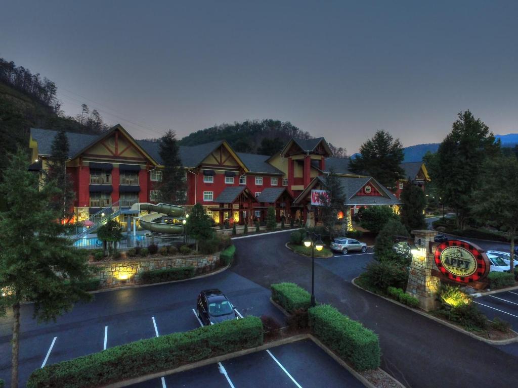
The Appy Lodge
Just a short distance from Anakeesta, Ripley’s Aquarium of the Smokies, and Ole Smoky Moonshine Distillery, The Appy Lodge offers a charming blend of comfort and convenience in the heart of Gatlinburg. Guests can unwind in the hot tub, enjoy a swim in either the seasonal outdoor pool or indoor pool, and stay active at the on-site gym. The hotel also features a terrace, business center, gift shop, and free self-parking. Each of the 101 rooms is designed with guest comfort in mind, offering premium bedding, air conditioning, free WiFi, and thoughtful amenities like flat-screen TVs, mini fridges, and microwaves. With laundry facilities, 24-hour front desk service, and tour assistance available, The Appy Lodge delivers a relaxed, welcoming stay just minutes from the area’s top attractions.
Buy Now
The Park Vista
Rising above downtown Gatlinburg on Cherokee Orchard Road, The Park Vista offers a quieter hillside stay with sweeping city and Smoky Mountain views. Families can enjoy the multi-level indoor pool complex with waterslides, a children’s area, and whirlpool, while several on-site dining options make breakfast, coffee, drinks, and relaxed evening meals convenient. Guest rooms include king, two-queen, and double-king configurations, with select rooms offering balconies and designated mountain or city views. Complimentary Wi-Fi, Hilton Honors benefits, connecting-room options, and a free Gatlinburg trolley stop at the hotel add practical value. Breakfast and self-parking cost extra, so compare the complete rate before booking. With its distinctive circular tower, full-service amenities, and separation from the Parkway crowds, The Park Vista is especially well suited to families, couples, and national park visitors who value scenery over immediate downtown walkability.
Check Availability Now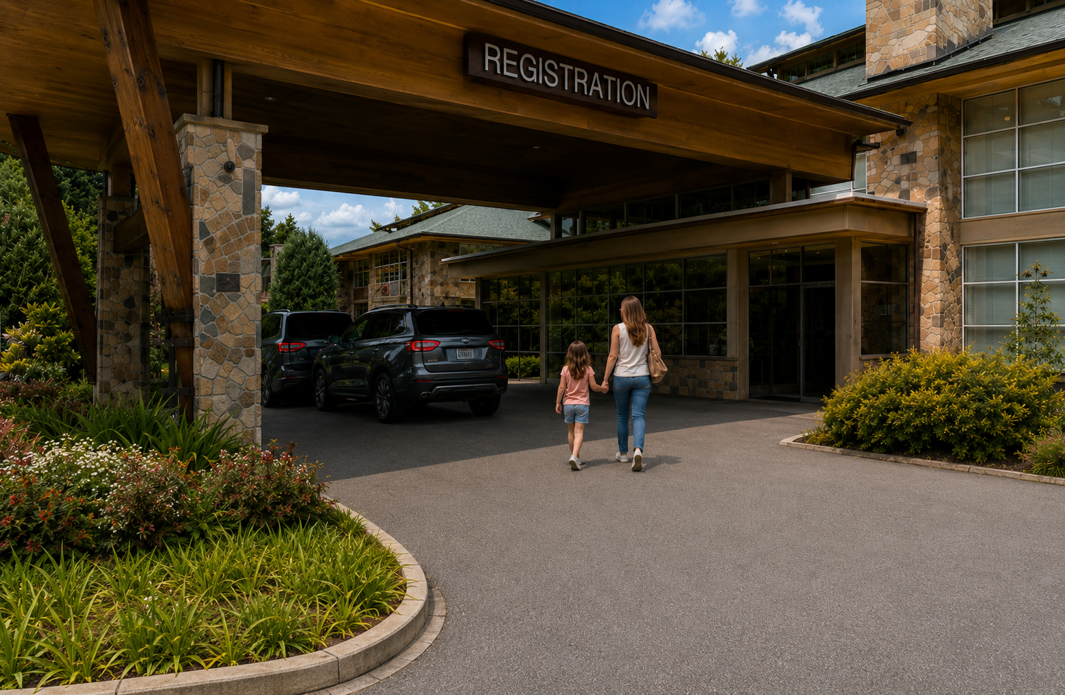
Greystone Lodge on the River
Set beside the river in the heart of downtown Gatlinburg, Greystone Lodge on the River offers an exceptionally convenient base beside Ripley’s Aquarium of the Smokies and just across the Parkway from Anakeesta. Guests receive complimentary breakfast, free self-parking, free Wi-Fi, and access to a seasonal heated outdoor pool with a waterslide. Every room includes a balcony or ground-floor patio, while selected riverfront rooms and suites add water views, fireplaces, soaking tubs, or family-friendly sleeping arrangements. A trolley stop at the hotel entrance provides another easy way to explore town. Greystone does not offer an indoor pool, spa, or on-site restaurant, and not every room overlooks the river, so check the exact room category before booking. With its walkable location, included essentials, and relaxed riverfront setting, Greystone is especially well suited to families, couples, and first-time visitors who want to leave the car parked and spend their holiday exploring Gatlinburg.
Check Availability Now
Embassy Suites by Hilton Gatlinburg Resort
Set less than half a mile from downtown Gatlinburg, Embassy Suites by Hilton Gatlinburg Resort offers a modern, family-focused stay near the Great Smoky Mountains National Park. Guests receive complimentary made-to-order breakfast, free Wi-Fi, and access to the nightly Evening Reception. Spacious accommodations, an indoor pool, and a seasonal outdoor pool complex with a lazy river and waterslide make the resort particularly appealing to families planning a multi-night stay. An on-site restaurant, bar, fitness centre, and pet-friendly rooms add further convenience. Embassy Suites is not directly on the Parkway, however, and the uphill return from downtown may prove tiring for young children or travellers with limited mobility. On-site self-parking also carries a nightly charge, while the lazy river and waterslide are seasonal. With its additional living space, included breakfast, and unusually strong pool facilities, Embassy Suites is best suited to families and larger groups who will use the amenities enough to justify the higher total price.
Check Availability Now
Old Creek Lodge
Set along a mountain stream on River Road, Old Creek Lodge offers a comfortable base between downtown Gatlinburg and the entrance to Great Smoky Mountains National Park. Every room includes a private stream-facing balcony, gas fireplace, mini-refrigerator, microwave, and Keurig coffee maker, giving the property more character and practicality than a typical downtown hotel. Guests also receive complimentary continental breakfast, free Wi-Fi, free on-site parking, and access to a heated seasonal outdoor pool. The western Parkway, Ober Mountain Aerial Tramway, and several restaurants and attractions are within walking distance, although destinations near Ripley’s Aquarium and Anakeesta require a longer stroll. Old Creek Lodge does not offer an indoor pool, restaurant, bar, spa, or extensive resort facilities, and pets are not permitted. Whirlpool tubs are available only in selected Spa room categories. With its creekside balconies, fireplaces, convenient location, and consistently strong guest feedback for cleanliness and service, Old Creek Lodge is particularly well suited to couples, small families, and park-focused travelers who prefer room atmosphere and walkability over resort-style extras.
Check Availability Now
The Historic Gatlinburg Inn
Set directly on the Parkway in the heart of downtown, The Historic Gatlinburg Inn offers a characterful base beside Gatlinburg SkyPark and across from the Gatlinburg Space Needle. Guests receive a complimentary Southern hot breakfast, free Wi-Fi, free on-site parking, and access to a seasonal outdoor pool, along with inviting common areas featuring fireplaces, historic photographs, puzzles, and porch rocking chairs. Room layouts vary considerably, with options ranging from traditional standard rooms to corner rooms with wraparound balconies, family suites, parlor arrangements, Presidential Suites, and Room 388, where “Rocky Top” was written. Standard rooms do not automatically include a mini-refrigerator, microwave, or balcony, so guests should confirm the exact category before booking. The inn does not offer an indoor pool, hot tub, spa, fitness centre, full-service restaurant, or bar, and pets are not permitted. With its exceptional walkability, included parking and breakfast, authentic Gatlinburg history, and frequently praised hospitality, The Historic Gatlinburg Inn is particularly well suited to couples, families, music enthusiasts, and repeat visitors who value independent character over modern resort-style amenities.
Check Availability Now
Hilton Garden Inn Gatlinburg
Set on River Road just off the busier Parkway, Hilton Garden Inn Gatlinburg offers a comfortable, walkable base near downtown and the Great Smoky Mountains. Rooms include microwaves, mini-refrigerators, and coffee makers, while selected categories add balconies, fireplaces, whirlpool tubs, or additional suite space. Guests also have access to an indoor saltwater pool, outdoor hot tub, courtyard fire pit, fitness center, and The Garden Grille & Bar. The hotel welcomes pets for an additional fee and participates in Hilton Honors. Breakfast is available but generally not complimentary, and on-site self-parking currently costs extra. It is best suited to couples and families who value dependable branded comfort and a slightly quieter downtown location.
Check Availability Now
Hampton Inn Gatlinburg
Set along LeConte Creek at 967 Parkway, Hampton Inn Gatlinburg offers a convenient downtown base near restaurants, attractions, and the Great Smoky Mountains. Rooms include mini-refrigerators, microwaves, and coffee makers, while selected categories add private balconies, creek views, or fireplaces. Guests also have access to complimentary hot breakfast, free Wi-Fi, an outdoor pool, hot tub, and fitness center. The hotel welcomes dogs and cats for an additional fee and participates in Hilton Honors. Covered parking is available, although on-site self-parking currently costs extra. It is best suited to couples, families, pet owners, and park visitors who value excellent Parkway walkability and a creek-side setting more than extensive resort-style amenities.
Check Availability Now
Hotel Indigo
Hotel Indigo Gatlinburg Downtown brings a more modern, boutique feel to the edge of downtown, with 136 rooms and a location that keeps restaurants and attractions within walking distance. Its standout feature is the seasonal heated rooftop infinity pool, joined by mountain views, a pool bar, and Altitude Restaurant & Rooftop Bar. Guests also have a lobby café serving Starbucks, fitness center, free Wi-Fi, EV charging, and dog-friendly accommodations. Self-parking currently costs $15 per day, and the rooftop pool operates seasonally from April 15 through October 31. It is best suited to couples and short-stay visitors who value walkability, contemporary rooms, and a rooftop atmosphere over the extra space and privacy of a cabin.
Check Availability Now


Trail Guides
The best hiking trails in the Great Smoky Mountains all promise beautiful scenery, but they don’t all deliver the same experience. Some lead to waterfalls after an easy morning walk. Others demand thousands of feet of climbing before rewarding you with sweeping mountain vistas. That’s why I’ve never believed in simply ranking hikes from best to worst. Instead, I prefer asking a different question: Which trail best matches the kind of day you want to have?
The trail guides below all follow the same format so you can compare them easily. You’ll find the practical planning details first, followed by an honest assessment of who the trail is best for, what makes it special, and the local tips I’ve picked up after returning to the Smokies over the years. My goal isn’t to convince you to hike every trail—it’s to help you choose the one you’ll still be talking about long after your boots are back in the closet.
Alum Cave Trail
Quick Facts
| Trailhead Location | Newfound Gap Road (US-441), approximately 8.6 miles south of Sugarlands Visitor Center |
| Round Trip Distance | Approximately 4.6 miles to Alum Cave Bluffs |
| Elevation Gain | About 1,125 feet |
| Typical Hiking Time | 3–5 hours |
| Difficulty | Moderate |
| Parking Difficulty | Very High — Arrive around sunrise during spring, summer weekends, and fall foliage season. A valid Park It Forward parking tag must be displayed before leaving your vehicle. |
| Restrooms | Vault toilets at the trailhead (no running water or sinks) |
| Best Seasons | Spring, Fall, Winter (with extra caution) |
| Dogs Allowed | No. Pets are prohibited on park trails. |
Why Hike Alum Cave?
If someone asked me to recommend one trail that showcases everything people love about the Smokies, Alum Cave Trail would almost always be my answer. Few hikes in the park change as dramatically from beginning to end. Instead of walking through the same forest for several miles, you’ll cross rushing mountain streams, squeeze through a natural stone arch, climb beside exposed cliffs, stand beneath one of the park’s most impressive rock formations, and watch the surrounding forest gradually transform as you gain elevation.
One of the reasons this trail remains so popular is its flexibility. Reaching Alum Cave Bluffs creates an outstanding half-day adventure that feels complete on its own. Hikers with more time and energy can continue another 3 miles to Mount LeConte, turning the outing into one of the most rewarding full-day hikes in Great Smoky Mountains National Park. That flexibility allows visitors to tailor the experience to both their schedule and fitness level without feeling as though they’ve settled for a lesser destination.
Unlike some mountain trails that save all the scenery for the summit, Alum Cave begins rewarding you almost immediately. Within the first mile you’ll hear rushing water, cross sturdy log bridges, and find yourself climbing through terrain that feels increasingly wild despite being one of the park’s best-known hikes. The changing scenery keeps the climb interesting from beginning to end.
Who This Trail Is Perfect For
Alum Cave Trail is an outstanding choice for hikers who want dramatic scenery without committing to an extreme backcountry expedition. If you’ve completed moderate hikes before and don’t mind a steady uphill climb, this trail offers one of the highest scenery-to-effort ratios anywhere in the Smokies.
Photographers, geology enthusiasts, and travelers visiting during autumn often find themselves lingering longer than expected because there’s always another interesting composition around the next bend. Spring brings wildflowers and energetic mountain streams, while crisp fall mornings wrap the surrounding ridges in colorful hardwood forests. Even experienced hikers who eventually continue to Mount LeConte often describe Alum Cave itself as one of the most memorable parts of the journey.
Families with toddlers may find portions of the trail challenging because of exposed roots, uneven rocks, and narrow stairways. Active older children and teenagers, however, usually enjoy the constantly changing terrain far more than longer trails where the scenery remains relatively unchanged for several miles.
Trail Personality
A classic Smoky Mountain adventure where every mile feels different from the one before.
Some trails are memorable because of a spectacular destination. Alum Cave is memorable because the entire hike feels like a collection of highlights connected together. Every section introduces something new, making the miles seem to pass more quickly than the map suggests.
One of my favorite parts of the hike isn’t actually a landmark at all—it’s noticing how quietly the forest changes. The lower elevations are filled with rich Appalachian hardwoods, rhododendron thickets, and rushing creeks. As you climb higher, the air gradually becomes cooler and noticeably fresher. By the time you approach the bluffs, especially on a warm summer morning, it often feels as though you’ve climbed into an entirely different climate. That subtle transition is one of the reasons I never tire of hiking this trail.
What You’ll Experience
The hike begins beside Alum Cave Creek, where the trail follows lively mountain water through a cool hardwood forest. Several sturdy log bridges carry hikers across the creek, while rhododendron tunnels provide welcome shade throughout much of the lower section. Early in the morning, sunlight filtering through the trees creates beautiful photography opportunities before larger crowds arrive.
One of the trail’s first signature landmarks is Arch Rock, a remarkable natural opening carved through solid rock by centuries of erosion. Reaching it requires climbing a steep, narrow stone staircase that passes directly through the arch itself. A steel cable handrail provides additional support, and hikers should expect this section to become a natural bottleneck during busy weekends as people pause to take photographs or carefully navigate the wet stone steps.
A short distance later, the trail reaches Inspiration Point, where the forest suddenly opens to reveal expansive mountain views across the surrounding valleys. It’s an excellent place to stop for a short break, not only because of the scenery but also because the climb becomes more sustained afterward. If you look carefully toward the towering rock faces, you may even spot peregrine falcons, which have nested in this area and are occasionally seen soaring above the cliffs.
The destination for many hikers is Alum Cave Bluffs, an enormous concave rock overhang rising roughly 80 feet above the trail. Despite its name, it isn’t a true cave but a massive overhanging bluff formed by weathering and mineral-rich rock. Standing beneath it on a warm afternoon provides an immediate drop in temperature that feels wonderfully refreshing after the climb. It’s one of those places where many hikers naturally sit for a while, enjoy a snack, and simply appreciate the quiet before deciding whether to continue toward Mount LeConte or begin the descent.
Things to Know Before You Go
Parking often proves more challenging than the hike itself. The trailhead sits along busy Newfound Gap Road, one of the park’s most popular corridors. During spring wildflower season, summer weekends, and October’s fall foliage, the parking lot frequently fills shortly after sunrise. Arriving early isn’t simply about securing a parking space—it also means cooler hiking temperatures, quieter trails, and better opportunities for wildlife viewing before the busiest hours begin.
Remember that vehicles parked for more than 15 minutes inside Great Smoky Mountains National Park require a valid Park It Forward parking tag displayed inside the vehicle before you leave the trailhead. There are no parking tag sales kiosks at the Alum Cave parking area, and cell service is unreliable, so it’s much easier to purchase or print your tag before arriving.
Wear proper hiking footwear with dependable traction. Exposed roots, uneven rock surfaces, damp stairways, and occasional muddy sections become especially slippery after rainfall. Trekking poles aren’t required, but many hikers appreciate the added stability during the descent, when tired legs can make footing less certain.
Mountain weather changes quickly here. The trail climbs from a relatively warm creek valley into noticeably cooler higher elevations, and temperatures at Alum Cave Bluffs often feel 10 to 15 degrees cooler than they do in downtown Gatlinburg. Even during July, I carry a lightweight rain jacket or an extra layer because afternoon thunderstorms can develop with surprising speed.
Winter visitors should be aware of one additional hazard that doesn’t receive enough attention. Water continually drips over the top of Alum Cave Bluffs, forming large icicles during freezing weather. As temperatures rise later in the morning, these heavy ice formations can break loose and fall directly beneath the overhang. If you’re hiking during the winter months, admire the formations from a safe distance and move through the area beneath the bluffs without lingering.
If panoramic mountain scenery is one of the reasons you’re visiting the Smokies, you’ll also enjoy exploring Best Overlooks in the Great Smoky Mountains, where you’ll find additional viewpoints that pair beautifully with a day spent hiking Alum Cave Trail.
Chimney Tops Trail
Quick Facts
| Trailhead Location | Newfound Gap Road, also known as US-441, approximately 6.8 miles south of Sugarlands Visitor Center |
| Round Trip Distance | Approximately 3.8 miles |
| Elevation Gain | About 1,300 feet |
| Typical Hiking Time | 2–4 hours |
| Difficulty | Strenuous |
| Parking Difficulty | Very High. The small roadside lot often fills early during spring, summer weekends, and fall foliage season. A physical Park It Forward parking tag must be displayed before leaving your vehicle. |
| Restrooms | Vault toilets at the trailhead |
| Best Seasons | Spring and fall. Winter can be beautiful but icy. Summer is best started early. |
| Dogs Allowed | No. Pets are prohibited on park trails. |
Why It’s One of the Park’s Most Famous Trails
Few hikes in the Smokies pack as much effort, scenery, and mountain character into under four miles as Chimney Tops Trail. Long before hiking apps and social media lists, travelers were pulling off Newfound Gap Road to admire its sharp twin pinnacles rising above the forest. It remains famous because it offers a real mountain challenge without requiring an entire day.
The trail wastes no time. Within a few minutes of leaving the roadside lot, the sound of traffic fades behind the roar of Walker Camp Prong. Wooden footbridges cross boulder-filled water, and the forest quickly feels deeper than the map suggests. This is part of Chimney Tops’ appeal: it gives you the feeling of a backcountry climb while still fitting into a half-day itinerary.
It is also important to understand what the hike is today. Before the 2016 wildfires, hikers climbed beyond the current endpoint to scramble onto the exposed rock pinnacles. That final section is now permanently closed. The trail officially ends at the observation platform, which offers excellent views of the pinnacles and surrounding mountains without the unsafe scramble that once defined the hike.
Who This Trail Is Perfect For
Chimney Tops is best for active hikers who enjoy a steep, direct climb. If you like trails that make you work quickly and reward you with a strong sense of accomplishment, this one delivers. It is especially good for travelers who want a serious morning hike but still hope to have time afterward for a picnic, scenic drive, or late lunch in Gatlinburg.
This is not the trail I would choose for a gentle family stroll. The route gains about 1,300 feet in less than two miles, and much of that climb comes by way of more than 650 stone and locust-log steps built into the mountainside to control erosion. Those steps make the trail more sustainable, but they also turn the hike into something close to an outdoor stair-climber workout.
Older children and teenagers who are used to hiking may enjoy the challenge, especially because the trail changes frequently and never feels dull. Visitors with sensitive knees should be more cautious. The climb is demanding, but the descent can be harder on joints, particularly when the stone steps are damp.
Trail Personality
The Smokies’ most iconic short climb.
Chimney Tops has a different feel from many of the park’s longer, more gradual hikes. It is compact, steep, and energetic. You do not wander your way into the mountains here; you climb into them.
What I appreciate about this trail is its honesty. It tells you almost immediately what kind of day you are going to have. The lower creek crossings are scenic and inviting, but once the trail begins climbing the flank of Sugarland Mountain, the mood changes. The grade steepens, the steps keep coming, and the forest begins to open just enough to tease views of Mount LeConte and the surrounding ridges.
What You’ll Experience
The hike begins with a lively crossing of mountain water. The trail passes over sturdy timber footbridges spanning Walker Camp Prong and Road Prong, where clear water rushes around large boulders below. In spring, this lower section can be especially beautiful, with trillium, violets, and other wildflowers scattered along the forest floor.
As inviting as the creeks look, treat them with respect. After heavy rain in the high country, water can rise quickly in these drainages. Do not wade or swim here during or immediately after a downpour. What looks like a scenic stream can become a fast, dangerous torrent when storms unload higher up near Newfound Gap.
After the final creek crossing, Chimney Tops becomes much more serious. The path climbs sharply along the eastern side of Sugarland Mountain. This is why hikers sometimes lose sight of the actual pinnacles during the middle of the hike. You are not climbing straight up the Chimney Tops spires themselves. Instead, the trail gains elevation along the mountain flank before reaching the ridge and observation platform facing the rocky peaks.
The rebuilt stair sections are one of the defining features of the hike. More than 650 stone and locust-log steps lead hikers up the slope, creating a path that is both durable and demanding. On dry days, the steps feel like a steady workout. On wet days, they require patience and careful footing.
The official endpoint is the Chimney Tops Observation Platform, at roughly 4,550 feet. From here, you get a dramatic view of the jagged slate pinnacles and the surrounding high country. The platform was built after the 2016 wildfires to provide a safe viewing area while protecting the unstable and recovering summit area.
The closure beyond the platform is not a suggestion. Do not cross the gate or ignore the posted signs. The fire damaged the soil, roots, and fragile rock structure around the former summit route, making it unsafe for hikers and harmful to the recovering landscape. The view from the platform is the view you came for now, and it is still one of the finest short-hike rewards in the park.
Things to Know Before You Go
Parking is limited and fills early in busy seasons. If you want the best chance of starting smoothly, aim for a sunrise or early morning arrival, especially during spring wildflower season, summer weekends, and October foliage. The trailhead sits along Newfound Gap Road, one of the most heavily traveled corridors in the park.
A valid Park It Forward parking tag is required if your vehicle will be parked longer than 15 minutes. Daily tags are $5, weekly tags are $15, and they must be physically displayed in your vehicle. Do not count on buying one from your phone at the trailhead, where cell service is unreliable. If you forgot to get one ahead of time, the closest practical fallback is usually Sugarlands Visitor Center, where outdoor credit-card kiosks can print a physical tag.
Footwear matters here. The stone and log steps can become slick after rain, and the descent puts real pressure on knees and ankles. Hiking shoes with good traction are strongly recommended. Trekking poles are also helpful, not because the trail is technically complicated, but because they reduce strain on the downhill return.
Weather can change quickly along Newfound Gap Road. Summer hikers should begin early to avoid heat and afternoon thunderstorms. Winter hikers should expect ice, especially in shaded sections and on stone steps. If the trail is wet, icy, or fogged in, slow down and treat the descent with more caution than the climb.
The nearby Chimneys Picnic Area can be a rewarding post-hike stop when it is open. It sits just down the road from the trailhead and makes a convenient place to rest, cool down, and enjoy lunch beside the river after the climb. Be aware that it is seasonal, closes during winter, and has evening gate hours during warmer months, so do not assume it is always available late in the day.
Laurel Falls Trail
Quick Facts
| Trailhead Location | Little River Road, also signed as Fighting Creek Gap Road, approximately 3.5 miles west of Sugarlands Visitor Center |
| Round Trip Distance | Approximately 2.6 miles when open |
| Elevation Gain | About 314 feet |
| Typical Hiking Time | 1–2 hours when open |
| Difficulty | Easy to moderate when open; paved, but not flat |
| Current Status | Temporarily closed for a major rehabilitation project that began January 6, 2025, with an expected 18-month construction window |
| Parking Difficulty | Historically extremely high; parking improvements are part of the rehabilitation work |
| Restrooms | None at the trailhead; use Sugarlands Visitor Center before driving out |
| Best Seasons | Spring and fall when open |
| Dogs Allowed | No. Pets are prohibited on park trails. |
Why Families Love Laurel Falls
For decades, Laurel Falls has been the classic “first hike” for families staying in Gatlinburg. It offers what many first-time Smoky Mountain visitors hope to find: a short, straightforward walk through the forest to a real waterfall without committing an entire day to the trail.
The main appeal has always been accessibility by national park standards. The route is paved, relatively short, and easy to understand, which made it especially popular with families, casual walkers, and visitors who wanted a gentle introduction to hiking in the Smokies. In spring and early summer, mountain laurel and rhododendron have traditionally added color along the route, giving the trail a soft, woodland feel before the waterfall appears.
But for current trip planning, the most helpful advice is simple: do not treat Laurel Falls as an available hike until the National Park Service officially reopens it. The trail is closed for an extensive rehabilitation project, including trail widening, repairs to deteriorated asphalt, improved drainage, parking changes, and new formal viewing areas near the falls.
Who This Trail Is Perfect For
When open, Laurel Falls is best for casual walkers, families with children, older adults comfortable with a steady incline, and first-time visitors who want a scenic payoff without navigating rocky terrain. It is not a wilderness escape, and it is rarely quiet during peak travel periods, but it has long served as one of the park’s easiest waterfall introductions.
It is also worth correcting a common myth. “Paved” does not mean flat, effortless, or truly stroller-friendly. Before the closure, the trail had a steady uphill grade, broken asphalt in places, narrow sections, and drop-offs that made wheels more stressful than older travel guides suggested. Many parents discovered that pushing a stroller uphill for more than a mile on worn pavement was far more tiring than expected.
The rehabilitation work is designed to improve those pain points, but visitors should wait for the park’s official reopening details before assuming how the finished trail will feel.
Trail Personality
The Smokies’ classic first waterfall hike — when it is open.
Laurel Falls has never been the trail for solitude seekers. Its personality is friendly, busy, and approachable. It is the kind of hike where you might see grandparents, young children, first-time hikers, and photographers all sharing the same path.
That popularity is exactly why the rehabilitation matters. The old trail was carrying more visitor traffic than it was built to handle. The updates should make the experience safer and more durable, but during construction, the only responsible advice is to choose another open trail.
What You’ll Experience
When Laurel Falls is open, the trail climbs steadily through hardwood forest toward an 80-foot, two-tiered waterfall. The route leads to a footbridge area where visitors can view the upper and lower sections of the falls, making it one of the easiest waterfall photo stops in the park.
The waterfall is the main reward. On warm days, the cool air near the cascade is refreshing, and morning light usually provides the best combination of softer photos and lighter crowds. The setting is especially appealing for visitors who want a memorable waterfall without committing to a longer hike like Rainbow Falls or Abrams Falls.
During the current closure, do not attempt to bypass gates, barriers, or construction fencing. The area is closed for active trail work and visitor safety. Ignoring the closure can bring fines and puts workers, hikers, and the fragile trail corridor at risk.
Things to Know Before You Go
Check Laurel Falls’ official reopening status before adding it to your itinerary. The project began January 6, 2025, and was expected to last about 18 months, but construction timelines can shift. If it has not reopened by your travel dates, choose Cataract Falls, Fighting Creek Nature Trail, or another open Gatlinburg-area hike instead.
If you are staying in Wears Valley or parts of Pigeon Forge, the Wears Valley entrance can sometimes be a useful way to reach Little River Road without driving through downtown Gatlinburg. It is not automatically faster for everyone, especially if you are already staying near the Sugarlands entrance, but it is worth considering when traffic on the Gatlinburg side is heavy.
When the trail reopens, expect strong demand immediately. Laurel Falls is too well known to stay quiet for long. Early morning will likely remain the best time to visit, especially during spring break, summer weekends, and fall foliage season.
Vehicles parked in Great Smoky Mountains National Park for more than 15 minutes require a physical Park It Forward parking tag displayed inside the vehicle. Daily tags are $5 and weekly tags are $15. Cell service around Laurel Falls has historically been unreliable, so purchase and print your tag before arriving. If you forget, Sugarlands Visitor Center is the closest practical stop with outdoor credit-card kiosks where you can print a parking tag.
Laurel Falls still belongs in a long-term guide to the best hiking trails in the Great Smoky Mountains, but the honest current advice is this: keep it on your future list, not your confirmed itinerary, until the park officially reopens the trail.
Rainbow Falls Trail
Quick Facts
| Trailhead Location | Cherokee Orchard Road, approximately 3.5 miles south of downtown Gatlinburg, just before the one-way entrance to the Roaring Fork Motor Nature Trail |
| Round Trip Distance | Approximately 5.4 miles |
| Elevation Gain | About 1,500 feet |
| Typical Hiking Time | 3–5 hours |
| Difficulty | Moderate to Strenuous |
| Parking Difficulty | High. Two dedicated parking lots often fill early during spring, summer weekends, and fall foliage season. Roadside parking is limited and closely monitored. |
| Restrooms | Vault toilets at the primary trailhead |
| Best Seasons | Spring, Fall, and Winter |
| Dogs Allowed | No. Pets are prohibited on park trails. |
Why It’s Worth the Climb
Rainbow Falls has always struck me as one of the most honest hikes in the Smokies. It never pretends to be easy, yet it rewards every bit of effort you invest. By the time you reach the waterfall, you’ve earned one of the park’s most spectacular natural landmarks rather than simply walking a short paved path to a scenic overlook.
At roughly 80 feet, Rainbow Falls is the tallest single-drop waterfall that can be reached by an official hiking trail in Great Smoky Mountains National Park. But the waterfall is only part of the experience. The trail follows LeConte Creek deep into a shaded mountain valley where rushing water, moss-covered boulders, towering tulip poplars, and mature hemlocks create the feeling that you’re gradually leaving civilization behind.
Another reason this hike remains one of my favorites is its flexibility. Many visitors hike to the falls, enjoy lunch, and head back satisfied with a memorable half-day adventure. Others continue climbing toward Mount LeConte, turning Rainbow Falls into the first stage of one of the Smokies’ classic summit hikes. It works equally well for someone seeking a rewarding waterfall or a serious mountain challenge.
Who This Trail Is Perfect For
Rainbow Falls is an excellent choice for hikers who don’t mind working for their scenery. Active couples, experienced hikers, teenagers who enjoy climbing, and anyone looking for a rewarding half-day adventure will likely appreciate this trail far more than shorter waterfall walks.
The trail surface is rarely difficult from a technical standpoint, but it demands steady effort. Exposed tree roots, uneven rocks, loose gravel, and a continuous uphill grade require supportive footwear and reasonable fitness. If you’re comfortable hiking for several hours without expecting long flat sections, you’ll probably enjoy this trail immensely.
Rainbow Falls is also a favorite starting point for hikers heading toward Mount LeConte. That means you’ll often share the lower trail with both casual waterfall hikers and experienced backpackers carrying overnight gear. It creates an interesting mix of visitors, but as the miles pass, the crowd naturally begins to spread out.
Trail Personality
A rewarding waterfall hike that feels increasingly wild.
Unlike Chimney Tops, which delivers its challenge almost immediately, Rainbow Falls slowly draws you deeper into the mountains. The steady climb gives the forest time to change around you. The farther you hike, the quieter everything becomes except the constant sound of LeConte Creek.
One thing I’ve noticed over the years is how peaceful this trail feels once you leave the first mile behind. Many visitors expecting a quick walk begin turning around before reaching the waterfall, while those who continue seem more interested in enjoying the journey than racing to the destination. That slower pace fits this trail perfectly.
What You’ll Experience
The hike begins beneath a dense canopy of mature cove hardwoods where LeConte Creek tumbles over smooth greenstone ledges beside the trail. Several sturdy bridges cross smaller tributaries, while countless unnamed cascades spill between moss-covered boulders. They’re easy to overlook, but some of my favorite photographs have come from these smaller waterfalls rather than the famous one waiting farther ahead.
As the climb continues, the trail gradually becomes rockier while remaining well maintained. You’ll gain elevation steadily without many opportunities for extended recovery, but frequent openings in the forest remind you that you’re climbing into higher country.
Eventually, the roar of falling water announces Rainbow Falls long before you actually see it. The 80-foot cascade plunges over a dark, curved cliff into a rocky basin below, creating one of the park’s most recognizable waterfalls. Many visitors expect the famous rainbow to appear during the morning, but local photographers know the best opportunity usually comes on clear days between about noon and mid-afternoon, when sunlight finally clears the surrounding ridges and shines directly into the mist rising from the base of the falls.
Winter transforms Rainbow Falls into something entirely different. During prolonged cold weather, the constant spray freezes into enormous curtains of ice surrounding the flowing water. The frozen formations are spectacular, but they also deserve respect. As temperatures warm later in the day, large chunks of ice can break loose from the cliff without warning. Admire the waterfall from a safe distance rather than lingering directly beneath the overhang.
Hikers continuing beyond Rainbow Falls toward Mount LeConte will notice another change. The crowds become noticeably thinner, the forest gradually transitions toward higher-elevation spruce and fir, and the trail begins feeling much more remote. Even if you plan to turn around at the waterfall, it’s easy to appreciate that you’re standing at the gateway to one of the park’s most celebrated mountain routes.
Things to Know
The climb is continuous. Rainbow Falls never feels brutally steep like Chimney Tops, but it also offers very few long, level sections where you can fully recover. Start at a comfortable pace, drink water regularly, and don’t be surprised if the return trip feels much easier than the climb in.
Bring plenty of water and sturdy hiking shoes. Roots, rocks, and damp sections become slippery after rainfall, and the steady elevation gain makes dehydration more noticeable than many first-time visitors expect.
Parking deserves some planning. The Rainbow Falls trailhead is located on Cherokee Orchard Road, before you reach the one-way entrance to the Roaring Fork Motor Nature Trail. This is an important distinction because some navigation apps and older travel guides can make it sound as though the trailhead is located inside the one-way scenic drive. It is not. Watch carefully for the parking lots before entering the Roaring Fork loop, or you’ll need to complete the scenic drive before returning.
If you’re planning to continue beyond Rainbow Falls toward Mount LeConte, be aware of current trail conditions. Through much of the 2026 hiking season, the Bullhead Trail is closed Monday through Thursday for a major rehabilitation project led by Friends of the Smokies. If you’re hiking on those weekdays, plan for an out-and-back return via Rainbow Falls unless official trail updates indicate otherwise.
Finally, purchase your Park It Forward parking tag before arriving. There are no parking tag kiosks at the Rainbow Falls trailhead, and cellular service becomes unreliable once you leave Gatlinburg and enter the Cherokee Orchard area. Daily parking tags cost $5, weekly tags cost $15, and the easiest approach is to purchase one in Gatlinburg or at Sugarlands Visitor Center before driving to the trailhead.
If waterfalls are the highlight of your Smoky Mountain itinerary, Rainbow Falls should be near the top of your list. For even more cascades ranging from short family walks to challenging backcountry adventures, continue with Waterfalls in the Great Smoky Mountains.
Andrews Bald
Quick Facts
| Trailhead Location | Forney Ridge Trailhead at the far end of the Kuwohi (formerly Clingmans Dome) parking area, at the end of Kuwohi Road |
| Round Trip Distance | Approximately 3.6 miles |
| Elevation Gain | About 900 feet of total climbing (the trail descends first and climbs back out) |
| Typical Hiking Time | 2–3 hours |
| Difficulty | Moderate |
| Parking Difficulty | High. The Kuwohi parking area is one of the busiest locations in Great Smoky Mountains National Park and often fills early from late spring through fall. A physical Park It Forward parking tag is required for vehicles parked longer than 15 minutes. |
| Restrooms | Vault toilets near the Kuwohi parking area |
| Best Seasons | Late spring, summer, and fall |
| Dogs Allowed | No. Pets are prohibited on park trails. |
Why This Is One of the Park’s Best Scenic Walks
Some of the Smokies’ best views require an exhausting climb from the valley floor. Andrews Bald takes a different approach. By the time you reach the trailhead, your drive has already carried you to more than 6,300 feet above sea level. Instead of spending hours climbing toward the high country, you begin your hike surrounded by the cool spruce-fir forest that only exists at the park’s highest elevations.
That makes Andrews Bald one of my favorite recommendations for travelers who want sweeping mountain scenery without tackling an all-day summit hike. The trail is certainly not effortless, but it feels surprisingly approachable considering the panoramic reward waiting at the end.
The destination itself is unlike almost anywhere else in the Smokies. Rather than standing on a narrow overlook, you’ll step onto one of the park’s largest remaining high-elevation grassy balds. The landscape suddenly opens in every direction, replacing dense forest with rolling meadows and uninterrupted mountain horizons that seem to continue forever.
Who This Trail Is Perfect For
Andrews Bald is an outstanding choice for photographers, couples, families with older children, and anyone who enjoys expansive scenery more than steep mountain climbing. It’s also perfect for visitors who have already walked to the Kuwohi Observation Tower and want a quieter experience away from the busiest crowds.
One reason I frequently recommend Andrews Bald is that many people underestimate how enjoyable high-elevation hiking can be. Even during the heat of July, temperatures here are often noticeably cooler than they are in Gatlinburg, making this one of the most comfortable summer hikes in the park.
There is one important strategy to understand before you begin.
This is an “inverse hike.”
Most mountain hikes ask you to climb first and descend back to your vehicle. Andrews Bald does exactly the opposite. The first half of the hike gradually descends toward the bald, making it feel easier than expected. The challenge comes at the end of the day, when you must climb roughly 500 feet back to the Kuwohi parking area. I’ve seen plenty of hikers relax a little too long on the bald, forgetting that the hardest walking is still ahead. Save enough water and energy for the return climb.
Trail Personality
Wide-open mountain views with surprisingly gentle hiking.
Every hike develops its own personality, and Andrews Bald feels wonderfully unhurried. There are no dramatic waterfalls, narrow ledges, or relentless stair climbs demanding your full attention. Instead, the trail encourages you to slow down, notice the changing forest, and enjoy the gradual transition from enclosed woodland to open mountain meadow.
One of my favorite parts of this hike is how dramatically the atmosphere changes during the first mile. You begin beneath a dense canopy of fragrant red spruce and Fraser fir, where cool mountain air carries the unmistakable scent of evergreen needles. Thanks to extensive restoration work completed by the park’s Trails Forever program, much of the route now features carefully constructed stone staircases and sturdy wooden boardwalks that protect the fragile high-elevation environment while making the trail more enjoyable to walk.
By the time the forest finally opens onto Andrews Bald, the transition feels almost theatrical. The trees step aside, the sky suddenly expands, and the mountains take over the horizon.
Highlights
The journey begins on Forney Ridge Trail, just beyond the busy Kuwohi parking area. Since the National Park Service officially restored the traditional Cherokee name Kuwohi in late 2024, visitors will now see that name on park maps, road signs, and trailhead information. Older guidebooks and websites may still refer to Clingmans Dome, but both names describe the same location.
The first portion of the trail winds through one of the Southern Appalachians’ rare spruce-fir forests. The cool, damp climate supports an ecosystem that feels remarkably different from the hardwood forests found lower in the park. Even during summer afternoons, the air often feels crisp enough to make you reach for a lightweight jacket.
The restored trail itself deserves appreciation. Years ago, sections of Forney Ridge Trail became muddy trenches after heavy rainfall. Today, beautifully crafted stone steps and elevated wooden boardwalks carry hikers across wet areas while protecting the surrounding landscape. It’s an excellent example of thoughtful trail restoration that improves both visitor experience and long-term conservation.
Eventually, the trees give way to Andrews Bald itself. The broad meadow stretches across the mountaintop with sweeping views into both Tennessee and North Carolina. Unlike many overlooks where visitors stop for only a few minutes, Andrews Bald invites you to linger. There is space to sit quietly, enjoy lunch, photograph the scenery, or simply watch clouds drift across the Blue Ridge.
If you visit in late June or early July, you’ll experience one of the Smokies’ most spectacular botanical displays. Thousands of vibrant Catawba rhododendrons bloom alongside brilliant flame azaleas, covering sections of the bald in shades of purple, orange, yellow, and red. The contrast between the colorful flowers, green meadows, and endless blue mountain ridges creates one of the park’s signature summer landscapes.
Autumn offers an entirely different reward. The surrounding hardwood forests glow with fall color while the grasses on the bald turn warm shades of gold. Visibility also tends to improve after autumn cold fronts, making this one of the finest long-distance viewpoints in the national park.
Planning Tips
Parking requires some planning because Andrews Bald shares its trailhead with one of the park’s most visited destinations. During summer, weekends, and the height of fall foliage, the Kuwohi parking area often fills early. Arriving shortly after sunrise remains the safest strategy, although visitors who prefer quieter afternoon hikes sometimes find the crowds thinning later in the day after tour buses and sightseeing traffic begin heading back down the mountain.
Weather deserves as much attention as the trail itself. At more than 6,000 feet above sea level, Andrews Bald creates its own microclimate. It’s common for temperatures to be 15 to 20 degrees cooler than they are in downtown Gatlinburg. Even during July, I carry a light jacket because wind and cloud cover can change conditions surprisingly quickly.
Fog is another reason to remain flexible. Some mornings begin completely socked in, with visibility measured in only a few yards. Instead of immediately giving up, consider waiting a while if your schedule allows. I’ve watched dense fog disappear in less than half an hour, revealing mountain ranges that had been completely hidden moments before. Late afternoon can also be surprisingly rewarding, as morning clouds often burn away, leaving crisp visibility and warm light across the surrounding peaks.
Finally, remember that the last mile is the hardest part of the hike. The uphill climb back to the Kuwohi parking area is steady but manageable if you’ve paced yourself throughout the day. Rather than rushing back, treat it as one final opportunity to enjoy one of the highest forests in the Great Smoky Mountains before returning to the crowds waiting at the overlook.
Charlies Bunion
Quick Facts
| Trailhead Location | Newfound Gap parking area on Newfound Gap Road (US-441), directly on the Tennessee–North Carolina state line |
| Round Trip Distance | Approximately 8.1 miles |
| Elevation Gain | About 1,640 feet |
| Typical Hiking Time | 4–6 hours |
| Difficulty | Moderate to Strenuous |
| Parking Difficulty | High. The large Newfound Gap parking lot fills quickly during weekends, summer, and fall foliage season. A physical Park It Forward parking tag is required for vehicles parked longer than 15 minutes. |
| Restrooms | Permanent restroom facilities at Newfound Gap |
| Best Seasons | Spring, fall, and clear winter days with proper gear |
| Dogs Allowed | No. Pets are prohibited on park trails. |
Why This Appalachian Trail Section Is So Popular
If you’ve ever wanted to experience the Appalachian Trail without committing to weeks or months of backpacking, Charlies Bunion is one of the finest introductions anywhere along its 2,000-plus-mile route. From the moment you leave Newfound Gap, you’re walking the same famous white-blazed trail that stretches from Georgia to Maine, crossing one of the highest and most scenic sections of the Great Smoky Mountains.
Unlike many of the park’s waterfall hikes, this adventure is about the mountains themselves. The route follows the crest of the Smokies, weaving through fragrant spruce-fir forests before gradually opening onto exposed ridges where the views seem to grow wider with every mile. By the time you reach the rocky outcrop at Charlies Bunion, you’ve earned one of the most dramatic panoramas in the national park.
I often recommend this hike to visitors who want something that feels adventurous without requiring technical climbing. It demands effort, but every mile brings changing scenery that makes the journey feel shorter than the distance suggests.
Who This Trail Is Perfect For
Charlies Bunion is an excellent choice for experienced day hikers, active couples, photographers, and anyone who prefers expansive mountain landscapes over waterfall destinations. If you’ve already explored some of the park’s shorter trails and want a hike that truly feels like you’ve ventured into the high country, this is a natural next step.
The trail is rocky, uneven, and long enough to require preparation. Good hiking shoes, plenty of water, and steady pacing will make the day much more enjoyable. While determined teenagers often do well here, I wouldn’t recommend this hike for young children or visitors looking for a leisurely morning walk.
It’s also a wonderful alternative for travelers who find the paved overlooks around Kuwohi too busy. Here, every viewpoint is earned on foot, and that effort creates a much stronger connection to the landscape.
Trail Personality
An unforgettable ridge walk.
Charlies Bunion has a personality that’s difficult to describe until you’ve experienced it yourself. It feels quieter, wilder, and more remote than many of the Smokies’ famous trails. Although Newfound Gap is often bustling with visitors taking photos beside the state line sign, that energy fades surprisingly quickly once you begin climbing the Appalachian Trail.
Within the first mile, the sounds of passing traffic disappear beneath the wind moving through the spruce trees. The forest feels older, the air noticeably cooler, and the trail carries a quiet sense of purpose. You’re sharing the path with day hikers, section hikers, and Appalachian Trail thru-hikers, all moving at their own pace toward different destinations.
There’s also something deeply satisfying about following the familiar white trail blazes. Even if this is your only Appalachian Trail hike, it offers a glimpse into why so many people dream of walking this remarkable footpath.
Highlights
The hike begins at Newfound Gap, where the Appalachian Trail immediately climbs into one of the park’s beautiful high-elevation spruce-fir forests. Temperatures here are often 10 to 15 degrees cooler than they are in Gatlinburg, especially during summer.
As you continue along the ridge, the forest occasionally opens to reveal impressive views into both Tennessee and North Carolina. Roughly halfway through the hike, you’ll pass Icewater Spring Shelter, where Appalachian Trail thru-hikers often spend the night during their long journey north or south.
One interesting detail many first-time visitors don’t realize is that the actual Charlies Bunion viewpoint sits on a short 0.1-mile spur trail off the main Appalachian Trail. It’s clearly marked, but don’t accidentally stay on the main trail or you’ll miss the destination entirely.
Likewise, don’t stop too early. About 200 yards before reaching Charlies Bunion, you’ll encounter a rocky viewpoint sometimes called Little Bunion. It offers a nice view, and many tired hikers mistakenly believe they’ve reached the end. Keep walking a few more minutes until you arrive at the much larger, unmistakable rock outcrop that gives the hike its reputation.
Charlies Bunion itself has an interesting story. The exposed rock formation became much more prominent after a devastating wildfire in 1925, followed by flooding that stripped away vegetation. Later, mountain guide Charlie Conner brought writer and park advocate Horace Kephart to see the unusual formation. Looking at the jagged rock, Kephart joked that it resembled the bunion on Charlie’s foot, and the colorful name has remained ever since.
Standing on the outcrop today, it’s easy to understand why generations of hikers have considered this one of the finest viewpoints in the Smokies. Mountain ridges stretch toward every horizon, and on exceptionally clear days, visibility seems almost endless.
Planning Tips
Charlies Bunion is a ridge hike, which means weather deserves as much attention as distance. Conditions can change quickly, and strong winds are common even when Gatlinburg enjoys calm, sunny weather. Carry an extra layer, even during summer, and postpone your hike if thunderstorms are expected. Exposed ridges are not places you want to be when lightning moves into the mountains.
Use caution once you reach the viewpoint. The exposed rock is part of the Anakeesta Formation, a mixture of slate and shale that becomes surprisingly slick after rain, frost, or morning dew. The dramatic views come with equally dramatic drop-offs, so stay well back from the edges and avoid climbing beyond the established viewing area.
If you’re feeling strong on the return trip, consider taking the short spur trail to The Jump-Off from the nearby Boulevard Trail junction. This additional walk adds about 0.6 mile round trip and rewards hikers with another spectacular overlook featuring sheer cliffs and expansive views into the Mount Kephart area. It’s one of those side trips that many visitors overlook but experienced Smokies hikers often recommend.
Parking requires planning. Although Newfound Gap has one of the park’s largest parking areas, it also serves thousands of visitors who stop simply to enjoy the overlook. During summer weekends and throughout October, arrive early—ideally before the main sightseeing traffic builds—to avoid long waits for a parking space.
Finally, remember to carry your physical Park It Forward parking tag if your vehicle will remain parked longer than 15 minutes. Once you’re on the mountain, cell service can be inconsistent, so it’s much easier to purchase and display your tag before arriving. That small bit of preparation allows you to spend your day focused on one of the Great Smoky Mountains’ finest ridge hikes instead of worrying about your vehicle back at the trailhead.
Abrams Falls
Quick Facts
| Trailhead Location | Abrams Falls Trailhead on the western side of the Cades Cove Loop Road, approximately 5 miles into the one-way loop |
| Round Trip Distance | Approximately 5.2 miles |
| Elevation Gain | About 675 feet (rolling ridge-and-valley profile) |
| Typical Hiking Time | 3–4 hours |
| Difficulty | Moderate |
| Parking Difficulty | High. The gravel parking lot often fills by mid-morning during spring, summer, and fall. A physical Park It Forward parking tag is required for vehicles parked longer than 15 minutes. |
| Restrooms | Vault toilets at the trailhead |
| Best Seasons | Spring, summer, and fall |
| Dogs Allowed | No. Pets are prohibited on park trails. |
Why This Waterfall Is Different
If you judged waterfalls strictly by height, Abrams Falls probably wouldn’t make your list of must-see hikes. At only about 20 feet tall, it looks modest on paper compared to Rainbow Falls or several other cascades throughout the Smokies.
Then you hear it.
Long before the waterfall comes into view, the roar echoes through the trees. Abrams Creek carries an enormous volume of water, squeezing through a narrow rock channel before crashing into a deep emerald basin below. The result is one of the most powerful waterfalls in Great Smoky Mountains National Park. It’s a reminder that height alone never tells the whole story.
I’ve always appreciated how Abrams Falls feels different from the more famous hikes near Gatlinburg. Instead of climbing toward lofty overlooks or dramatic cliffs, this trail immerses you in the quieter side of Cades Cove, where dense forest, flowing creeks, and peaceful woodland scenery gradually build anticipation before revealing one of the park’s most impressive waterfalls.
Who This Trail Is Perfect For
Abrams Falls is an excellent choice for visitors who want a rewarding half-day hike while already exploring Cades Cove. Rather than simply driving the scenic loop, this trail gives you a chance to stretch your legs and experience a very different side of the valley.
It works particularly well for hikers who enjoy wooded trails more than exposed mountain ridges. Instead of one long climb, the route follows an undulating pattern, crossing several forested ridges before descending toward Abrams Creek. Those repeated climbs aren’t especially steep, but they do surprise visitors expecting an easy walk to the waterfall.
If you’ve already completed hikes like Laurel Falls or Grotto Falls and you’re ready for something a little longer without committing to an all-day summit adventure, Abrams Falls is a natural next step.
Trail Personality
A moderate hike ending at one of the park’s most powerful waterfalls.
Abrams Falls has a steady, relaxed rhythm. The trail never feels overly technical, but it constantly changes as it winds through mature hardwood forest, crosses small ridges, and returns toward Abrams Creek.
One thing I’ve learned after several visits is not to think of this as a simple creek-side stroll. The trail repeatedly climbs over low ridges before dropping back toward the water, creating a gentle roller-coaster profile. You earn the waterfall through several moderate climbs rather than one continuous ascent.
Early mornings are especially enjoyable here. Before the busiest crowds arrive in Cades Cove, the forest feels remarkably peaceful. Birdsong replaces traffic noise, sunlight filters through towering tulip poplars and oaks, and Abrams Creek quietly accompanies much of the hike.
Highlights
The adventure begins with a sturdy footbridge crossing Abrams Creek before entering a beautiful hardwood forest filled with tulip poplars, white pines, oaks, and scattered hemlocks. Throughout the hike, the trail climbs over three distinct wooded ridges before gradually descending toward the waterfall.
Those rolling hills keep the scenery changing. Spring brings carpets of wildflowers beneath fresh green leaves. Summer offers welcome shade beneath the mature canopy, while autumn transforms the forest into one of the Smokies’ finest woodland displays as gold, orange, and crimson leaves cover the trail.
The final descent becomes increasingly dramatic as the sound of rushing water grows louder. When the trees finally open, Abrams Falls suddenly appears, pouring tremendous amounts of water through a narrow sandstone channel into a large emerald plunge pool below.
The waterfall’s beauty also hides its greatest danger.
Despite looking inviting on warm days, the plunge pool is considered one of the most hazardous swimming areas in Great Smoky Mountains National Park. Powerful hydraulic currents, hidden underwater ledges, and strong recirculating water have contributed to numerous serious accidents over the years. Even experienced swimmers can underestimate the force created by the confined channel. The safest way to enjoy Abrams Falls is from the shoreline while respecting all posted warning signs.
Planning Tips
The biggest challenge often isn’t hiking Abrams Falls—it’s getting there.
Because the trailhead sits about 5 miles into the one-way Cades Cove Loop Road, your hike begins with navigating one of the park’s busiest scenic drives. Wildlife sightings frequently create traffic backups, especially when black bears or deer appear near the road. During peak travel periods, what normally feels like a short drive can easily take an hour or more.
If you’re visiting between the first Wednesday in May and the last Wednesday in September, remember that Cades Cove is closed to motor vehicles every Wednesday. The trail remains open, but reaching it becomes a much larger adventure. Since the trailhead is approximately 5 miles into the loop, hikers and cyclists must travel those extra miles before even beginning the 5.2-mile Abrams Falls hike. Unless you’re specifically looking for a very long day outdoors, most visitors will find another day of the week much more enjoyable for this hike.
Parking also deserves attention. The Abrams Falls lot fills quickly once Cades Cove traffic builds, so arriving early in the morning greatly improves your chances of finding a space while enjoying cooler hiking temperatures.
Finally, don’t forget your physical Park It Forward parking tag before entering Cades Cove. There are no parking tag kiosks at the trailhead, and cellular service inside the valley is unreliable. Taking care of that small detail before you arrive allows you to spend your day focused on the hike instead of worrying about your vehicle.
If you’re planning to spend a full day exploring Cades Cove, pairing Abrams Falls with Scenic Drives in the Great Smoky Mountains creates one of the most memorable combinations in the national park. The historic valley, abundant wildlife, and powerful waterfall complement one another perfectly and showcase why this area remains one of the Smokies’ most beloved destinations.
Mount LeConte via Alum Cave
Quick Facts
| Trailhead Location | Alum Cave Trailhead on Newfound Gap Road (US-441), approximately 8.6 miles south of Sugarlands Visitor Center |
| Round Trip Distance | Approximately 11.0 miles to LeConte Lodge, or about 11.5 miles if you include the short walk to Cliff Tops |
| Elevation Gain | About 2,760 feet |
| Typical Hiking Time | 6–8 hours |
| Difficulty | Strenuous |
| Parking Difficulty | Very High. The Alum Cave Trailhead is one of the busiest in Great Smoky Mountains National Park. Arrive early, especially during spring, summer, and fall. A physical Park It Forward parking tag is required for vehicles parked longer than 15 minutes. |
| Restrooms | Vault toilets at the trailhead; public day-hiker privy near LeConte Lodge |
| Best Seasons | Late spring through fall; winter requires advanced preparation and traction devices may be necessary |
| Dogs Allowed | No. Pets are prohibited on park trails. |
Why It’s a Bucket List Hike
If someone asked me to recommend the single hike that best captures everything the Great Smoky Mountains have to offer, Mount LeConte via Alum Cave would be very near the top of my list. It’s one of those rare trails that never feels repetitive. Every couple of miles the landscape changes, the forest changes, and even the temperature reminds you that you’re climbing into a completely different environment.
Unlike many famous hikes that build toward one spectacular viewpoint, this one delivers memorable moments throughout the day. You begin beside a rushing mountain creek, climb through the narrow passage of Arch Rock, stand beneath the immense overhang of Alum Cave Bluffs, carefully cross exposed mountainside ledges, and eventually emerge into one of the highest forests in the eastern United States.
Reaching Mount LeConte also feels special because of its history. Instead of ending at a simple overlook, you arrive at LeConte Lodge, a remote collection of rustic cabins that has welcomed hikers since the 1920s. The lodge, surrounded by towering Fraser firs and supplied by llama pack trains throughout the season, gives the summit an atmosphere unlike anywhere else in the Smokies.
Who This Trail Is Perfect For
Mount LeConte is an outstanding goal for experienced day hikers who want to spend an entire day immersed in the mountains. You don’t need technical climbing skills, but you should be comfortable hiking for six to eight hours over rocky terrain with significant elevation gain.
I often tell visitors that the best way to decide whether Mount LeConte is right for them is to evaluate how they feel when they reach Alum Cave Bluffs. If you’re already exhausted there, it’s perfectly reasonable to turn around. Beyond the bluffs, the trail becomes steeper, quieter, and more physically demanding. There is no shame in saving the summit for another trip.
This hike also appeals to travelers who enjoy history as much as scenery. Walking into LeConte Lodge after several hours on the trail feels less like reaching a destination and more like arriving at a tiny mountain village hidden deep within the national park.
Trail Personality
The Smokies’ classic all-day mountain adventure.
This hike has a personality that slowly unfolds rather than announcing itself all at once.
The first few miles are energetic and social. Families, photographers, and hikers heading only to Alum Cave Bluffs share the trail. Once you climb beyond the bluffs, however, everything changes. The crowds become noticeably thinner, conversations fade, and the mountain begins to feel much larger.
One of my favorite moments always comes shortly after leaving Alum Cave Bluffs behind. The trail begins crossing the rocky slopes of Peregrine Peak, where steel cable handrails have been anchored into exposed cliff sections to provide extra security. These ledges aren’t technical climbing, but they demand your attention. Looking out across the Sugarlands Valley from these narrow traverses is one of those moments that reminds you just how much elevation you’ve gained.
Higher still, the hardwood forest gradually disappears. Red spruce and Fraser fir replace maples and oaks, the air becomes noticeably cooler, and the scent of evergreen fills the trail. Even during July, it can feel like you’ve stepped into an entirely different climate zone.
Highlights
The journey begins on the familiar Alum Cave Trail, following Alum Cave Creek through one of the park’s most scenic valleys. Early landmarks such as Arch Rock, Inspiration Point, and Alum Cave Bluffs are destinations in their own right, but they’re only the beginning of what this hike offers.
Above Alum Cave Bluffs, the mountain reveals a quieter side. The trail narrows, climbs steadily, and crosses the exposed rock face of Peregrine Peak. Steel cable handrails help hikers negotiate these cliff-side sections, particularly when rain or lingering spring ice makes the rock slippery.
Eventually the forest levels out and the trail enters the summit area surrounding LeConte Lodge. The lodge has welcomed hikers for generations and remains one of the highest guest lodges in the eastern United States. Even if you’re not spending the night, it’s worth taking time to appreciate the unique atmosphere. During designated day-hiker hours, visitors may purchase the lodge’s famous fresh-baked cookies or a hearty sack lunch, and potable spring water is available for refilling water bottles and hydration bladders.
Many hikers assume the lodge marks the summit, but that’s only part of the story.
The true summit of Mount LeConte is High Top, located about half a mile beyond the lodge along the Boulevard Trail. Unlike the dramatic overlooks nearby, High Top sits quietly beneath dense forest canopy. A large stone cairn marks the highest point, and many hikers continue the tradition of placing a small rock on the pile before turning back.
Before beginning your descent, don’t miss Cliff Tops, a short side trail from the lodge that rewards hikers with one of the finest panoramic views in the Smokies. Looking west across layer upon layer of blue ridges after spending hours climbing to reach them is one of those moments that stays with you long after the hike ends.
Planning Tips
Mount LeConte deserves an early start. Not only does this improve your chances of finding parking at the busy Alum Cave Trailhead, but it also gives you time to enjoy the summit without constantly watching the clock. Rushing through a hike like this misses much of what makes it memorable.
Weather deserves careful attention. Conditions at LeConte are often dramatically different from those in Gatlinburg. Summer afternoons can bring fast-moving thunderstorms, while spring and autumn frequently produce cold temperatures, dense fog, and strong winds. During late winter and early spring, ice often lingers around the exposed cable sections near Peregrine Peak long after the valleys have warmed. Carry traction devices if icy conditions are possible, and always pack an extra insulating layer.
Water and nutrition are equally important. Carry enough water to comfortably reach the summit, then take advantage of the potable spring water available near LeConte Lodge if it’s operating during your visit. Likewise, although the lodge offers snacks and sack lunches during designated hours, think of those as a welcome bonus rather than your primary meal plan. Always carry sufficient food for the entire hike.
Finally, remember that reaching Mount LeConte is only the halfway point. The long descent places just as much demand on tired knees and ankles as the climb did on your lungs. Trekking poles can make a tremendous difference during the return trip, especially on the rocky sections above Alum Cave Bluffs.
The hikers who seem happiest at the end of the day aren’t necessarily the fastest—they’re the ones who pace themselves, stop to enjoy the changing forests, and understand that Mount LeConte is meant to be experienced rather than conquered.
Kuwohi Observation Tower Trail (formerly Clingmans Dome)
Quick Facts
| Trailhead Location | Kuwohi Parking Area at the end of Kuwohi Road (formerly Clingmans Dome Road), accessed from Newfound Gap Road (US-441) |
| Round Trip Distance | 1.0 mile |
| Elevation Gain | Approximately 330 feet |
| Typical Hiking Time | 30–60 minutes |
| Difficulty | Moderate (short distance, but a very steep paved climb) |
| Parking Difficulty | Very High. The large parking lot often fills by 8:30 a.m. from late spring through peak fall color season. |
| Seasonal Access | Kuwohi Road is normally closed to motor vehicles from December 1 through March 31 due to snow and ice. During that period, the road may be accessed only by hiking or cross-country skiing when conditions allow. |
| Restrooms | Vault toilets at the parking area |
| Visitor Services | Kuwohi Visitor Center with information, exhibits, and a Great Smoky Mountains Association bookstore and gift shop |
| Dogs Allowed | No. Pets are not permitted on this trail. |
Why Everyone Should Visit Kuwohi
If there is one place I encourage every first-time visitor to experience, it is Kuwohi—formerly known as Clingmans Dome. Standing at 6,643 feet above sea level, it is the highest point in Great Smoky Mountains National Park, the highest mountain in Tennessee, and one of the highest viewpoints anywhere in the eastern United States. The National Park Service officially restored the mountain’s original Cherokee name, Kuwohi, in late 2024, and visitors today will see that name on road signs, maps, and trailhead information throughout the park.
What makes Kuwohi remarkable isn’t simply its elevation. Most panoramic mountain summits require hours of climbing, but here your vehicle does almost all of the work. After driving seven scenic miles along Kuwohi Road from Newfound Gap Road, you’re only a short walk away from views that many hikers spend an entire day trying to reach elsewhere.
Every visit feels different. I’ve stood here watching sunrise paint the ridges in soft gold, returned during summer afternoons wrapped in drifting clouds, and watched autumn sunsets stretch across what seemed like endless layers of blue mountains. Even after multiple trips, I still find myself lingering longer than planned because the view has a way of slowing you down.
Trail Personality
The easiest way to experience one of the highest viewpoints in the eastern United States.
Although this is one of the shortest walks in the Smokies, don’t underestimate it. The paved trail climbs steadily at grades reaching roughly 15 to 20 percent, and the thinner air at over 6,000 feet makes that incline feel noticeably steeper than the numbers suggest.
Many visitors expect an easy stroll because they see pavement. Instead, they discover that the climb quickly elevates their heart rate. My advice is simple: slow your pace. There is no prize for reaching the tower first, and taking your time allows you to appreciate the unique high-elevation environment surrounding you.
This trail is ideal for travelers who may not be interested in an all-day hike but still want one of the park’s greatest panoramic rewards.
Accessibility Note: Although the trail is paved, it is not considered ADA accessible because of its sustained, steep grade. Visitors using standard wheelchairs, pushing strollers, or those with significant mobility, respiratory, or cardiac concerns should carefully consider the physical demands before beginning the climb.
Highlights
The experience begins at the stone plaza beside the Kuwohi Visitor Center, the highest visitor facility in the national park. Before or after your walk, it’s worth spending a few minutes inside. The exhibits provide helpful information about the mountain’s ecology and history, while the Great Smoky Mountains Association bookstore offers excellent field guides, maps, and locally focused books that are far more useful than typical souvenir-shop offerings.
The trail immediately enters one of the park’s rare spruce-fir forests. The atmosphere changes almost instantly. The air becomes cooler and noticeably drier, carrying the fresh scent of Fraser fir and red spruce. Even during July, it can feel more like early autumn than midsummer in Gatlinburg.
As you climb, you’ll notice something that surprises many first-time visitors: hundreds of gray, skeletal tree trunks rising above the living forest. At first glance they appear lifeless and almost haunting. These standing dead trees are the result of the balsam woolly adelgid, an invasive insect that devastated mature Fraser fir forests beginning in the 1960s. Fortunately, there is hope beneath those gray silhouettes. Look down and you’ll often see dense carpets of young fir saplings slowly reclaiming the mountain, evidence that the forest continues to regenerate.
The trail ends at the famous concrete observation tower. Its gently curving ramp rises above the treetops until you’re standing nearly 360 degrees above the surrounding landscape. On exceptionally clear days after a passing cold front, visibility can approach 100 miles. Ridge after ridge stretches across Tennessee and North Carolina, fading into increasingly softer shades of blue.
Sunrise offers some of the quietest moments on the mountain, often with mist filling the valleys below. Sunset can be equally rewarding as warm evening light washes across the ridges. Both are well worth planning for if your schedule allows.
Planning Tips
Mountain weather deserves your full attention here. Kuwohi routinely runs 15 to 20 degrees cooler than downtown Gatlinburg, and strong winds can develop with little warning. I’ve left Gatlinburg in short sleeves only to find myself reaching for a jacket at the summit. Even during summer, I always carry an extra layer.
Fog is simply part of visiting Kuwohi. Some mornings the observation tower disappears into thick cloud, while thirty minutes later the skies suddenly clear. If your first view is completely hidden, don’t rush away. I’ve had several visits where patience turned a gray wall of fog into one of the clearest panoramas of the trip.
Parking requires planning as well. From late spring through peak fall foliage season, the parking area often fills early. Arriving before 8:00 a.m. usually provides the best combination of available parking, lighter crowds, and calmer conditions for photography. Vehicles parked longer than 15 minutes must display a valid Park It Forward parking tag.
Finally, remember that Kuwohi Road normally closes to motor vehicles from December 1 through March 31 because snow and ice make the high-elevation roadway unsafe. Winter visitors who hope to reach the summit should always check current road conditions before making the drive to Newfound Gap. When conditions permit, hiking or skiing the closed roadway offers a completely different—and wonderfully peaceful—way to experience the highest reaches of the Smokies.
Ramsey Cascades
Quick Facts
| Trailhead Location | Ramsey Cascades Trailhead at the end of Ramsey Prong Road in the Greenbrier section of Great Smoky Mountains National Park (accessed from US-321, about 6 miles east of Gatlinburg) |
| Round Trip Distance | 8.0 miles |
| Elevation Gain | Approximately 2,375 feet |
| Typical Hiking Time | 5–7 hours |
| Difficulty | Strenuous |
| Parking Difficulty | Moderate to High. The gravel parking lot is smaller than those at Newfound Gap or Kuwohi and often fills by mid-morning on weekends and during fall color season. A valid Park It Forward parking tag is required for vehicles parked longer than 15 minutes. |
| Restrooms | Vault toilets at the trailhead |
| Best Seasons | Spring and fall offer the most comfortable hiking conditions, though the trail is beautiful year-round. |
| Dogs Allowed | No. Pets are prohibited on park trails. |
Why Experienced Hikers Love It
Ramsey Cascades has a reputation for being one of the most rewarding hikes in the Great Smoky Mountains because it offers something many popular trails no longer can—a genuine feeling of wilderness. It isn’t simply a hike to a waterfall. It’s a journey through one of the finest remaining old-growth forests in the eastern United States that ends beneath the tallest waterfall accessible by trail in the national park.
Unlike hikes that begin alongside busy scenic roads, Ramsey Cascades feels quieter almost immediately. The Greenbrier entrance receives far fewer visitors than Newfound Gap Road or Cades Cove, and that difference becomes obvious within the first mile. Instead of hearing constant traffic or large hiking groups, you’ll mostly hear rushing water, birdsong, and the breeze moving through towering hardwoods.
The waterfall itself drops roughly 100 feet over layered rock ledges. It isn’t the widest waterfall in the Smokies, but it is one of the most dramatic. By the time you reach it after hours of climbing, the sight and sound of cascading water feel genuinely earned.
Who This Trail Is Perfect For
Ramsey Cascades is best suited for experienced hikers who enjoy spending an entire day on the trail. While the mileage alone doesn’t seem overwhelming, the elevation gain, rocky footing, and sustained climb make this one of the park’s more physically demanding waterfall hikes.
If you appreciate ancient forests as much as mountain vistas, this trail belongs near the top of your list. Some of the tulip poplars growing along the middle section of the trail exceed 20 feet in circumference and are estimated to be more than 300 years old. Standing beside trees that were already mature long before the American Revolution provides a different kind of perspective than standing on a mountain overlook.
This isn’t the hike I’d recommend for young children, first-time hikers, or anyone hoping to finish before lunch. Ramsey Cascades rewards patience, preparation, and realistic expectations.
Trail Personality
A demanding journey through old-growth forest.
One reason I enjoy Ramsey Cascades is that the trail changes character as you climb. The opening miles follow an old logging road beside the Middle Prong of the Little Pigeon River. It’s a pleasant beginning that allows you to settle into a comfortable pace while listening to fast-moving water beside the trail.
After crossing the large footbridge around the halfway point, everything changes. The old road disappears, and the trail narrows into a rugged mountain path lined with exposed roots, boulders, and increasingly steep switchbacks. From here, the hike feels much more like true backcountry travel.
The old-growth forest becomes the star of the experience. Massive tulip poplars, eastern hemlocks, basswoods, and yellow birches create an enormous canopy overhead. Moss blankets fallen logs and rocks, while ferns thrive in the cool, damp shade. Even on warm summer afternoons, this section of the trail often feels noticeably cooler than lower elevations.
By the final mile, you’ll begin hearing the waterfall before you see it. The roar grows steadily louder as the trail climbs toward the viewing area, building anticipation until the forest finally opens to reveal Ramsey Cascades spilling over dark rock into the boulder-filled basin below.
Highlights
The towering old-growth forest is unlike anything found on many of the park’s more heavily visited trails. Looking upward instead of outward becomes part of the experience as enormous trunks disappear into the canopy above.
The Middle Prong of the Little Pigeon River remains your companion for much of the hike. Several sturdy footbridges cross rushing mountain streams, and countless smaller cascades tumble through the forest long before you reach the main waterfall.
The final approach becomes increasingly rugged. Large rocks, uneven footing, and steeper grades demand careful attention, particularly when descending later in the day with tired legs.
Ramsey Cascades itself is an impressive 100-foot waterfall divided into multiple tiers as water pours over massive rock formations. Unlike waterfalls viewed from roadside overlooks, this one feels tucked deep within the forest, making the destination all the more memorable.
Planning Tips
Start early and treat Ramsey Cascades as a full-day adventure rather than trying to squeeze it between other attractions. Carry plenty of water, energy-rich snacks, and enough food for several hours on the trail. There are no services once you leave the parking area.
Avoid hiking after periods of heavy rain. Stream crossings become more challenging, exposed rocks grow extremely slick, and the final approach to the waterfall requires much more caution. Good hiking boots with reliable traction are highly recommended, and trekking poles can make the descent considerably easier.
Bear awareness is especially important in the Greenbrier and Ramsey Prong corridor. The National Park Service has occasionally issued temporary trail closures or advisories because of concentrated black bear activity in this area. Never leave your backpack unattended, even while taking photographs. If you encounter a bear, remain calm, keep your distance, speak firmly, make yourself appear larger, and slowly back away. Never run, and never intentionally abandon food or your pack to encourage a bear to approach people in the future.
Finally, resist the temptation to climb onto the wet rocks surrounding the base of Ramsey Cascades. They remain slick throughout the year because of constant spray, and serious injuries—including fatalities—have occurred when visitors ventured beyond the designated viewing area. The safest place to appreciate the falls is also one of the best viewpoints, allowing you to take in the full height and power of the tallest waterfall in Great Smoky Mountains National Park while respecting both the landscape and your own safety.
Gregory Bald
Quick Facts
| Trailhead Location | Gregory Ridge Trailhead at the end of Forge Creek Road, accessed from the Cades Cove Loop Road between stops 4 and 5 |
| Round Trip Distance | 11.4 miles |
| Elevation Gain | Approximately 3,020 feet |
| Typical Hiking Time | 6–8 hours |
| Difficulty | Strenuous |
| Parking Difficulty | Low to Moderate. The gravel parking area is rarely as crowded as Newfound Gap trailheads, but reaching it depends on traffic through Cades Cove. A valid Park It Forward parking tag is required for vehicles parked longer than 15 minutes. |
| Restrooms | None at the trailhead. The last public restrooms are at the Cades Cove Campground and Cable Mill Visitor Center before entering Forge Creek Road. |
| Best Seasons | Mid-June for peak flame azaleas, summer for mountain meadows, and autumn for crisp weather and expansive views |
| Dogs Allowed | No. Pets are prohibited on park trails. |
Why It’s One of the Park’s Hidden Gems
Gregory Bald isn’t famous because it’s the tallest summit or the hardest hike in Great Smoky Mountains National Park. It’s beloved because it offers something that’s becoming increasingly difficult to find—true mountain solitude paired with one of the park’s most remarkable natural displays.
Unlike the rocky overlooks around Newfound Gap or the bustling observation tower at Kuwohi (formerly Clingmans Dome), Gregory Bald feels wonderfully understated. You spend hours climbing through quiet forest before emerging onto an expansive grassy summit where the views stretch in nearly every direction. There’s no railing, no concrete platform, and no crowd gathered around a single viewpoint. Instead, you’re free to wander the open meadow and experience the landscape at your own pace.
The bald is internationally recognized among botanists for its extraordinary population of naturally hybridized flame azaleas. Around the middle of June, the summit erupts into a mosaic of orange, gold, crimson, peach, salmon, and soft pink blooms unlike anywhere else in the Smokies. Even if you visit outside bloom season, the peaceful atmosphere and sweeping mountain scenery make Gregory Bald feel like one of the park’s best-kept secrets.
Who This Trail Is Perfect For
Gregory Bald is best suited for experienced hikers who enjoy earning quiet places. If your ideal hike ends with a peaceful meadow instead of a crowded overlook, this trail delivers exactly that experience.
The distance and sustained climb make it an all-day commitment. This isn’t the hike to squeeze in before dinner reservations in Gatlinburg. It’s the kind of trail where you slow your pace, enjoy the forest, eat lunch on the summit, and let the day unfold naturally.
Wildflower photographers, serious landscape photographers, birdwatchers, and hikers who appreciate long, uninterrupted walks through mature forest often rank Gregory Bald among their favorite trails in the entire park.
Trail Personality
A peaceful mountain summit far from the crowds.
Gregory Ridge Trail is wonderfully consistent. From the first steps, it begins climbing through mature hardwood forest alongside Forge Creek. Several sturdy footbridges cross lively mountain streams, and the constant sound of rushing water keeps you company during the lower miles.
What surprises many first-time hikers is how few overlooks there are during the climb. For nearly the entire ascent, the forest surrounds you completely. Rather than offering frequent scenic rewards, the trail builds anticipation one mile at a time. The steady climb becomes almost meditative.
Eventually the forest begins changing. Hardwood trees gradually give way to higher-elevation oak and pine communities before the trail reaches Sheep Pen Gap. Then, almost without warning, the trees fall away entirely.
Stepping from the shaded woods onto Gregory Bald feels dramatic every single time. After spending hours enclosed beneath a green canopy, you’re suddenly standing beneath an enormous sky surrounded by rolling grass, scattered shrubs, and mountain ridges fading into the distance. It’s one of the Smokies’ most memorable transitions between forest and open landscape.
Highlights
The broad summit is unquestionably the highlight of the hike. Gregory Bald rises to 4,949 feet and provides panoramic views across Cades Cove, the western Smokies, and the mountains of North Carolina. Unlike narrow rocky overlooks where everyone crowds into one photograph, the grassy summit offers plenty of room to spread out and appreciate the scenery.
The mountain’s greatest claim to fame arrives each year during the narrow bloom window between approximately June 15 and June 25, when the famous hybrid flame azaleas typically reach their peak. Timing varies slightly with spring weather, but this mid-June period consistently offers the best chance of seeing the summit transformed into one of the finest native wildflower displays in the eastern United States.
The colors are astonishing. Rather than blooming in a single shade, the naturally hybridized shrubs display fiery oranges, brilliant yellows, deep reds, peach, coral, salmon, and soft pink blossoms all growing together across the meadow. It’s easy to understand why photographers and botanists return year after year.
One of my favorite moments comes after sitting quietly for a while. Once the initial excitement fades, you begin noticing the smaller details—the breeze moving through the grass, butterflies drifting among the azaleas, and layers of blue mountains stretching toward the horizon. Gregory Bald encourages you to linger instead of simply checking another destination off your list.
Planning Tips
Gregory Bald requires thoughtful planning before you even begin hiking. The trailhead sits off Forge Creek Road, which is accessed from the Cades Cove Loop Road. From the first Wednesday in May through the last Wednesday in September, Cades Cove is closed to motor vehicles every Wednesday. While hikers and cyclists may still enter the loop, reaching the Gregory Ridge Trailhead on those days requires roughly 5½ miles of walking or biking each way before you even start the 11.4-mile hike. Unless you’re intentionally planning an exceptionally long day, choose another day of the week.
Traffic through Cades Cove can also add significant time to your morning. Wildlife sightings frequently create slow-moving “bear jams,” particularly during summer and autumn. I try to enter Cades Cove shortly after sunrise whenever Gregory Bald is my destination. The earlier start usually means lighter traffic, cooler hiking temperatures, and plenty of time to enjoy the summit without watching the clock.
Weather deserves careful attention here. Gregory Bald is completely exposed, offering little protection from wind, lightning, or rapidly changing mountain conditions. Afternoon thunderstorms develop quickly during summer, and fog can drift across the summit with surprisingly little warning. Carry rain gear, extra layers, and enough water for a full day on the trail, even if Gatlinburg feels warm when you leave.
For photographers hoping to capture sunrise, sunset, or the peak azalea bloom without hiking several rugged miles in darkness, Backcountry Campsite 13 at Sheep Pen Gap is worth considering. Located roughly half a mile below the summit, it provides a convenient overnight option for those with the proper backcountry permit and allows you to experience Gregory Bald during the quietest hours of the day.
Gregory Bald isn’t a trail that impresses through constant excitement. Instead, it rewards patience. The long forest climb, the gradual anticipation, and the sudden arrival on an open mountain meadow create an experience that stays with you long after you’ve descended back into Cades Cove. For hikers who believe the best places are often the ones requiring a little extra effort, Gregory Bald more than lives up to its reputation.
Deep Creek Three Waterfalls Loop
Quick Facts
| Trailhead Location | Deep Creek Campground & Picnic Area, at the end of Deep Creek Road near Bryson City, North Carolina |
| Round Trip Distance | 2.4 miles (classic three-waterfall loop, excluding the Juney Whank spur) |
| Elevation Gain | Approximately 350 feet |
| Typical Hiking Time | 1.5–2 hours |
| Difficulty | Easy to Moderate |
| Travel Time from Gatlinburg | Approximately 1½–2 hours via Newfound Gap Road (US-441 South) |
| Parking Difficulty | Moderate. The National Park Service lot fills quickly during tubing season. A Park It Forward parking tag is required when parking in park lots for more than 15 minutes. |
| Restrooms | Seasonal public restrooms near the main parking area |
| Best Seasons | Spring wildflowers, summer tubing, autumn foliage |
| Dogs Allowed | No. Pets are prohibited on park trails. |
Why It’s Perfect for Families
If someone asked me where I’d send a family looking for an easy day in the Smokies without spending hours climbing a mountain, Deep Creek would be near the top of my list. It offers something many areas of Great Smoky Mountains National Park can’t: several beautiful waterfalls, gentle walking, rushing mountain streams, and one of the park’s most popular tubing destinations—all within a relatively compact area.
Unlike many hikes around Gatlinburg, Deep Creek doesn’t revolve around reaching one dramatic destination after miles of climbing. Instead, the scenery unfolds gradually. Within minutes you’ll hear waterfalls, cross sturdy bridges, walk beside crystal-clear streams, and watch children skipping stones while hikers continue farther into the forest.
Deep Creek also provides a refreshing change of scenery. Sitting near Bryson City on the North Carolina side of the national park, it feels quieter and more relaxed than many of the Tennessee trailheads. Although the drive from Gatlinburg takes about 1½ to 2 hours over Newfound Gap Road, I’ve found it’s well worth dedicating an entire day to this part of the park instead of trying to squeeze it into a busy Gatlinburg itinerary.
Trail Personality
A relaxing day of waterfalls and forest streams.
Deep Creek isn’t about conquering a summit or standing on an exposed cliff. It’s about slowing down.
The wide gravel paths follow lively mountain streams beneath a leafy hardwood canopy. Water is almost always within earshot, whether it’s flowing gently over smooth rocks or tumbling over one of the area’s waterfalls. During summer, colorful inner tubes drift downstream while hikers stroll beside the creek, giving the entire valley an easygoing atmosphere that feels more like a mountain vacation than an endurance hike.
The area also gives you flexibility. Families with small children can enjoy a short waterfall walk, while hikers wanting a little more exercise can complete one of the loop combinations without committing to an all-day adventure.
Highlights
One of the biggest mistakes first-time visitors make is assuming all three waterfalls sit along one continuous trail. They don’t.
Juney Whank Falls begins from its own separate trail immediately behind the main parking area. It’s a short but steeper loop that crosses a footbridge in front of the waterfall before returning to the trailhead. If you want to see all three waterfalls, it’s easiest to visit Juney Whank first before starting the main creek walk.
The classic Deep Creek experience follows this sequence:
Deep Creek Trail → Indian Creek Trail → Loop Trail → Deep Creek Trail
This 2.4-mile route offers the best balance of scenery and manageable hiking.
Shortly after leaving the parking area on Deep Creek Trail, you’ll reach Tom Branch Falls, an elegant waterfall cascading directly into Deep Creek. Benches nearby make this one of the nicest places in the Smokies to simply sit and enjoy the sound of rushing water.
Continuing farther upstream brings you to the junction with Indian Creek Trail. A brief detour leads to Indian Creek Falls, where a powerful curtain of water plunges into a deep pool beneath a dense canopy of hardwoods. It’s one of the most photogenic waterfalls in this section of the park.
The Loop Trail then climbs gently through mixed forest before reconnecting with Deep Creek Trail for an easy downhill return. It’s the only section with noticeable elevation gain, but most families handle it comfortably with a few short breaks.
Spring blankets the forest floor with trillium, violets, and other native wildflowers. During summer, tubing becomes part of the scenery as visitors float through the creek alongside portions of the trail. Autumn transforms the valley into a colorful tunnel of gold, orange, and crimson leaves reflected in the clear mountain water.
Things to Know
Deep Creek deserves to be treated as a full-day excursion from Gatlinburg rather than a quick side trip. Between the scenic drive over Newfound Gap Road and time spent hiking, tubing, or exploring Bryson City afterward, it’s easy to fill an enjoyable day without feeling rushed.
Summer is by far the busiest season. Tubing attracts hundreds of visitors, especially on weekends. If you want quieter trails and easier parking, arrive early in the morning or visit during spring or fall.
If you’re planning to rent tubes, one local trick can save both time and frustration. Several private outfitters just outside the national park entrance allow customers to park free on their private lots with a tube rental. That means you can often skip the crowded National Park Service parking area entirely while still walking directly to the tubing launch.
Tubing itself varies depending on where you enter the creek. Upper sections feature quicker-moving water with playful Class I and II rapids that older children and adults usually enjoy. Lower sections closer to Tom Branch Falls are gentler and better suited to younger families looking for a more relaxing float.
Bring proper hiking shoes even if tubing is part of your plans. Water shoes and sandals are perfect for the creek but don’t provide enough support for the Loop Trail’s dirt climbs and occasional rocky sections.
Finally, don’t underestimate the drive. Crossing the Smokies via Newfound Gap is one of the most beautiful drives in the park, but weather, wildlife traffic, construction, and summer congestion can all add time. I always leave Gatlinburg earlier than I think I need to. That relaxed start makes the entire day feel more enjoyable.
If you’re building a longer Smokies itinerary, Deep Creek pairs beautifully with time exploring Bryson City before heading back across the mountains. It’s one of the best ways to experience a completely different side of the national park from the bustling Parkway. For even more ways to round out your vacation, explore Things To Do In Gatlinburg.
Guided Smoky Mountain Experiences
Not every memorable day in the Smokies has to involve navigating maps, choosing trails, or planning logistics yourself. Guided hikes, waterfall tours, Jeep adventures, wildlife excursions, and outdoor experiences can be excellent options for first-time visitors or anyone who simply wants to learn more about the mountains from someone who knows them well.
Local guides often point out details that are easy to miss on your own, from seasonal wildflowers and wildlife behavior to Appalachian history and hidden viewpoints. If you’d rather spend your day enjoying the scenery than worrying about directions or trail decisions, a professionally guided experience can be one of the most relaxing ways to discover the Great Smoky Mountains.
Best Hiking Seasons in the Great Smoky Mountains
One of the biggest mistakes I see first-time visitors make is assuming there’s a single “best” time to hike in the Great Smoky Mountains. After returning here year after year, I’ve learned that every season tells a different story. The same trail can feel like four completely different experiences depending on when you visit.
Spring fills the forests with wildflowers and roaring waterfalls. Summer invites you into cool mountain elevations while valleys grow warm and humid. Autumn transforms the ridges into one of America’s greatest foliage displays. Winter strips away the leaves and crowds, revealing long-distance views that remain hidden for most of the year.
Rather than asking, “What’s the best season?” I encourage travelers to ask a better question: What kind of hiking experience am I hoping for? Once you answer that, choosing the right season becomes much easier.
Spring (March–May)
If I could recommend only one season to someone visiting the Smokies for the first time, spring would be difficult to beat. The mountains feel alive again after winter. Streams roar with snowmelt and seasonal rains, wildflowers blanket the forest floor, and cool temperatures make longer hikes far more comfortable than they become later in the year.
One of spring’s most fascinating features is what park naturalists often call the “Green Wave.” Instead of spring arriving everywhere at once, new leaves gradually climb the mountainsides—roughly 100 feet of elevation each day as temperatures warm. In March, you’ll find bloodroot, trillium, and spring beauties carpeting lower valleys like Cades Cove and Greenbrier. By late April those same colors have climbed into the middle elevations, while the highest ridges near Kuwohi and Mount LeConte may still look surprisingly wintry. If you’re staying several days, you can actually follow spring uphill by choosing different elevations each day.
Waterfalls are equally spectacular during this season. Heavy spring runoff gives falls like Laurel Falls, Rainbow Falls, Abrams Falls, and Ramsey Cascades tremendous power. I’ve found that waterfalls photographed in April often look far more dramatic than they do by late summer, when creek levels naturally begin to decline.
The weather is usually excellent for hiking, although mountain conditions can change quickly. Mornings often begin cool enough for a light jacket before warming into ideal hiking temperatures. Afternoon showers remain possible, so carrying a lightweight rain shell is rarely a bad idea.
One important consideration many visitors overlook is wildfire season. Before the forest fully greens up, March and April can actually be among the park’s highest wildfire-risk months because dormant vegetation dries quickly during windy periods. Temporary burn restrictions occasionally affect campers and backcountry users, so it’s worth checking current park alerts before overnight trips.
If spring hiking appeals to you, you’ll also find more seasonal planning advice in Best Times to Visit the Great Smoky Mountains.
Summer (June–August)
Summer is the Smokies’ busiest hiking season, and for good reason. Families are on vacation, nearly every trail is accessible, wildflowers continue blooming at higher elevations, and daylight stretches well into the evening.
The secret to enjoying summer, however, isn’t choosing different trails—it’s choosing different hours.
I’ve learned that an early alarm clock often makes the difference between a peaceful mountain morning and a frustrating afternoon. Arriving at popular trailheads before 8:00 a.m. frequently means cooler temperatures, easier parking, quieter trails, and much better wildlife viewing. By late morning, many of the park’s most famous parking lots are already full.
When temperatures climb in Gatlinburg, consider heading higher into the mountains. Trails around Kuwohi (formerly Clingmans Dome), Andrews Bald, Charlies Bunion, and Mount LeConte can easily be 15 to 20 degrees cooler than the valleys below. That elevation difference turns what could be an exhausting hike into a remarkably comfortable one.
Afternoon thunderstorms deserve respect throughout the summer. Clouds often build surprisingly quickly over the higher ridges, especially after lunch. If you’re planning a long hike that includes exposed viewpoints, aim to finish those sections well before storms begin developing.
Another unique summer consideration affects hikers near Elkmont. During the annual synchronous firefly viewing period—typically around late May into early June—the National Park Service manages afternoon and evening vehicle access through a lottery system. If you’re hoping to hike trails around Elkmont during that event, be sure to check current access procedures in advance rather than assuming normal parking will be available.
Summer remains a wonderful time to explore the Smokies. You simply need to let the mountains set your schedule instead of trying to force one onto them.
Fall (September–November)
Ask longtime Smokies visitors about their favorite season and many won’t hesitate before answering: fall.
Cool mornings, comfortable afternoons, lower humidity, and extraordinary visibility make autumn nearly perfect hiking weather. After the first strong cold fronts sweep through the mountains, distant ridges become incredibly crisp. Some of my favorite panoramic photographs have come during October afternoons when it feels like every mountain range stretches endlessly toward the horizon.
Fall foliage doesn’t arrive everywhere simultaneously. Instead, color gradually moves downhill over several weeks.
Higher elevations around Kuwohi, Charlies Bunion, Andrews Bald, and Mount LeConte generally begin changing in early October. Mid-elevation trails often peak around the middle of the month, while valleys such as Cades Cove, Greenbrier, and Deep Creek frequently remain colorful into late October and early November.
Understanding this progression helps you plan smarter hikes. Visiting during early October? Spend your time high on the ridges. Arriving closer to Halloween? Lower elevations often provide richer color while many high ridges have already shed much of their foliage.
The tradeoff for this spectacular scenery is popularity. October is one of the busiest months in the national park. Popular trailheads often fill shortly after sunrise, and scenic roads experience significant congestion throughout the day. Beginning your hikes early not only improves parking opportunities but also lets you enjoy quieter trails before most visitors arrive.
For photographers, few seasons reward patience like autumn. Waiting until mid-morning often allows valley fog to lift while colorful forests remain beautifully illuminated by softer sunlight.
Winter (December–February)
Winter reveals a quieter side of the Smokies that many visitors never experience.
Without leaves covering the forests, distant ridges, historic stone walls, old homesteads, and hidden rock formations suddenly appear. Trails that seem enclosed during summer become surprisingly open, offering mountain views through bare hardwood forests that simply don’t exist during the growing season.
The peaceful atmosphere is one of winter’s greatest rewards. Even trails that attract hundreds of hikers during October may feel wonderfully solitary on a clear January morning.
Winter also requires the most preparation.
Higher elevations frequently experience temperatures 15 to 25 degrees colder than Gatlinburg, and snow or ice can linger long after valleys have warmed. Trails such as Alum Cave, Charlies Bunion, Mount LeConte, and Kuwohi often develop extensive icy sections where lightweight traction devices such as microspikes become strongly recommended for safe footing.
Road closures also become an important part of trip planning. Kuwohi Road normally closes to motor vehicles from December 1 through March 31. The Roaring Fork Motor Nature Trail typically remains closed from December 1 through April 30, making trailheads such as Grotto Falls inaccessible by vehicle during that period. Some secondary roads, including Forge Creek Road serving Gregory Bald access, also have seasonal closures or limited winter access depending on conditions.
Fortunately, winter doesn’t eliminate hiking opportunities. Lower-elevation areas such as Deep Creek, Greenbrier, Cataract Falls, Fighting Creek Nature Trail, and portions of Cades Cove often remain excellent choices during milder weather while avoiding much of the snow and ice found in the high country.
If you dress in layers, carry appropriate traction when needed, and remain flexible with changing weather, winter offers one of the park’s most peaceful and rewarding hiking seasons. Standing alone on a quiet trail after a light snowfall reminds you just how wild the Great Smoky Mountains can still feel.
Wildlife You May Encounter on Smoky Mountain Trails
One of the greatest rewards of hiking in the Great Smoky Mountains isn’t simply reaching a summit or standing beside a waterfall—it’s realizing you’re sharing the landscape with one of the richest collections of wildlife in North America. The park protects more than 19,000 documented species, with scientists believing thousands more remain undiscovered. Every trail, whether it’s a short family walk or a full-day backcountry adventure, passes through habitat that belongs first and foremost to the animals that live here.
That privilege comes with responsibility.
Federal regulations require visitors to remain at least 50 yards (150 feet) away from black bears and elk, and at least 25 yards from all other wildlife. It is a federal misdemeanor to intentionally approach within those distances or to remain close enough that your presence changes an animal’s natural behavior. Violations can result in substantial fines and even jail time.
A simple trick I’ve adopted over the years is the National Park Service’s “Rule of Thumb.” Hold your thumb at arm’s length toward the animal. If your thumb cannot completely cover the bear or elk, you’re too close. Back away slowly and give the animal more room.
The best wildlife encounters happen when the animal barely notices you’re there.
Black Bears
Black bears are the Smokies’ most famous residents, and with an estimated population approaching 1,900 bears throughout the park, your chances of seeing one are better here than in most places east of the Mississippi River.
Despite their reputation, most bears want nothing to do with hikers. The first bear I watched in the Smokies spent nearly twenty minutes quietly turning over logs for insects while completely ignoring everyone standing a safe distance away. Encounters like that remind you these are simply wild animals going about their day.
If you meet a bear on the trail, stay calm. Speak in a normal voice so it recognizes you’re human, slowly back away if necessary, and always leave the bear an escape route. Never run. Running can trigger a chase response, even from an otherwise calm animal.
Equally important is protecting the bear from people. Never feed wildlife, intentionally or accidentally. Keep all food secured inside your pack, never leave backpacks unattended during breaks, and pack out every scrap of trash. Bears that learn to associate hikers with food often become habituated, creating dangerous situations that sometimes end with the animal being euthanized.
If the bear stops feeding, watches you, or changes direction because of your presence, you’ve already gotten too close.
Elk
For many years, visitors traveled to Cataloochee Valley or Oconaluftee to see elk. Those areas remain outstanding wildlife viewing locations, but by 2026, elk have become increasingly established in parts of Cades Cove as well. Hikers heading toward Abrams Falls or Gregory Ridge occasionally encounter these impressive animals grazing near Hyatt Lane, Sparks Lane, and other open meadows.
Seeing an elk in the Smokies is unforgettable. Mature bulls can weigh well over 700 pounds, and during the autumn rut, their bugling echoes through mountain valleys in a way that’s difficult to describe until you’ve heard it yourself.
Their calm appearance can be deceptive.
Bull elk become especially protective during the fall breeding season, while cows fiercely defend calves during late spring and early summer. Always remain at least 50 yards away, and if an elk acknowledges your presence by looking directly at you, raising its head repeatedly, or changing its behavior, quietly increase your distance.
A telephoto lens or binoculars will always provide a better experience than trying to get closer.
White-Tailed Deer
White-tailed deer are probably the wildlife you’ll encounter most often. They browse along trail edges, wander through open meadows, and are especially active during the first and last hours of daylight.
I’ve found that some of the quietest hiking moments happen when you simply stop walking and allow a deer to continue feeding naturally. Those peaceful encounters only happen when people give wildlife the space it deserves.
Although deer seem harmless, resist the temptation to approach or feed them. During autumn, bucks can become territorial, and even does with fawns deserve plenty of room.
Wild Turkeys
Wild turkeys have made a remarkable comeback throughout the Smokies and are now common in places like Cades Cove, Greenbrier, and along quieter forest roads. In spring, toms fan their enormous tails and perform elaborate courtship displays that often become highlights for photographers.
Turkeys generally avoid people, but during nesting season it’s wise to give them plenty of space, particularly if young poults are nearby. Watching quietly from a distance allows you to witness natural behavior without interrupting it.
Venomous Snakes
Most snakes in the Great Smoky Mountains are harmless and play an important role in the park’s ecosystem. However, hikers should be aware of the park’s two venomous species: the timber rattlesnake and the northern copperhead.
Copperheads are masters of camouflage, blending almost perfectly into fallen leaves along lower-elevation trails and creek bottoms. Timber rattlesnakes are more often associated with rocky ledges, exposed slopes, and sunny outcrops where they can warm themselves. Hikers occasionally encounter them near rocky areas along trails such as Alum Cave, Abrams Falls, and other exposed mountain routes.
The good news is that snake encounters are uncommon, and bites are even rarer because snakes generally prefer to avoid people.
The best strategy is simple: watch where you place your hands and feet, especially when stepping over logs or climbing onto rocks. Never reach blindly into crevices or leaf piles. If you encounter a snake on the trail, stop, give it plenty of space, and allow it to move away on its own. There is no need to disturb or attempt to relocate it.
Salamanders
The Great Smoky Mountains proudly carry the nickname “Salamander Capital of the World,” and once you understand the numbers, it’s easy to see why. More than 30 species live here, including several found nowhere else on Earth.
These small amphibians thrive in the cool, damp forests that make the Smokies so distinctive. Look carefully beneath moss-covered logs, around shaded streams, or beside wet rock walls after a gentle rain, and you may spot one of these remarkable creatures.
One of my favorite discoveries wasn’t a bear or an elk—it was kneeling beside a quiet mountain stream and noticing a brilliantly colored salamander no longer than my finger. Moments like that remind you that the park’s greatest treasures aren’t always its largest ones.
Please admire salamanders without touching them. Their skin absorbs oils, sunscreen, and insect repellent from human hands, making even gentle handling harmful.
Birds
Birdsong provides the soundtrack for nearly every Smoky Mountain hike. More than 240 bird species have been recorded in the park, and each elevation offers something different.
Spring mornings often begin with warblers, thrushes, vireos, and woodpeckers filling the forest with song, while the high spruce-fir forests near Kuwohi and Mount LeConte support birds rarely found elsewhere in the southern Appalachians.
If birdwatching interests you, start hiking shortly after sunrise. The trails are quieter, temperatures are cooler, and birds are usually at their most active before the day warms.
Respect Wildlife and They’ll Reward You
The Great Smoky Mountains remain one of America’s greatest wildlife destinations because the animals here are still genuinely wild. Every respectful decision visitors make helps keep it that way.
Carry binoculars if wildlife is high on your wish list. Slow your pace. Keep conversations quiet. Accept that the best photograph may require a little patience rather than a few extra steps forward.
I’ve learned that the most memorable wildlife encounters rarely happen because I chased them. They happened because I stopped, stayed still, and let the mountains unfold at their own pace.
For more information about where different animals are commonly seen throughout the park, the best wildlife viewing seasons, and photography tips, explore Wildlife in the Great Smoky Mountains.
Essential Hiking Tips Before You Go
Some of the best hiking days I’ve had in the Great Smoky Mountains were successful long before I reached the trailhead. A few minutes spent preparing in Gatlinburg often saved hours of frustration later in the day. The Smokies are wonderfully wild, but they’re also a vast temperate rainforest where weather changes quickly, cellular service disappears without warning, and trailheads may sit miles from the nearest assistance.
I’ve learned to think of preparation as part of the adventure rather than a chore. When you arrive with the right gear, an understanding of mountain conditions, and realistic expectations, you spend less time solving problems and more time enjoying why you came.
Parking Tags Explained
Great Smoky Mountains National Park requires a Park It Forward parking tag for any vehicle parked longer than 15 minutes.
There are three options:
- Daily Tag – Ideal if you’re spending one day hiking.
- Weekly Tag – Usually the best value for most Gatlinburg vacations.
- Annual Tag – Perfect for frequent visitors and locals who return throughout the year.
Whenever possible, purchase your parking tag online before your trip or stop at one of the park’s visitor centers before heading to your hike. Sugarlands Visitor Center is the most convenient option for visitors staying in Gatlinburg, while Oconaluftee Visitor Center serves the North Carolina side of the park, and Cades Cove Visitor Center is a logical stop if you’re exploring the western section of the Smokies.
One improvement in recent years has made life easier for forgetful hikers. Several major trailheads—including Alum Cave, Kuwohi, and Deep Creek—now feature automated Park It Forward kiosks. These machines issue physical parking tags without requiring cellular service, but they accept credit cards only. Cash is not accepted.
Even with those kiosks available, I still recommend taking care of your parking tag before leaving town. It removes one more thing to think about on busy mornings when parking lots are filling quickly.
For more planning information, see Visitor Centers in the Great Smoky Mountains.
What to Pack
The Smokies reward preparation more than expensive gear. Your packing list doesn’t need to be complicated, but every item should earn its place.
Water should always be your first priority. Even moderate hikes become surprisingly demanding during humid summer weather, and there are many trails where reliable drinking water isn’t available without proper filtration. I also carry salty snacks and a few high-calorie energy bars because they travel well and provide steady energy during long climbs.
Layers are equally important. One of the easiest mistakes visitors make is dressing for downtown Gatlinburg instead of the mountains. Temperatures at Kuwohi or Mount LeConte can easily be 15 to 20 degrees cooler than the valleys.
A lightweight rain jacket stays in my backpack year-round. Afternoon showers arrive quickly, and staying dry makes every hike far more enjoyable.
Navigation deserves a little extra attention as well. While cellular data disappears across much of the park, your phone’s internal GPS continues working normally. Before leaving your hotel or cabin, download your trail maps through an offline navigation app such as AllTrails or Gaia GPS. Once you’re at the trailhead, switching your phone to Airplane Mode often preserves battery life by preventing it from constantly searching for a signal that doesn’t exist.
One lesson experienced hikers repeat for good reason is the phrase “Cotton kills.” Cotton shirts, jeans, and socks absorb sweat and rainwater, then hold that moisture against your skin. In a place where temperatures can drop suddenly, wet cotton accelerates heat loss and dramatically increases the risk of hypothermia. Synthetic fabrics or merino wool dry much faster and remain comfortable even after unexpected rain.
Mountain Weather
The Great Smoky Mountains create their own weather.
I’ve driven away from a sunny breakfast in Gatlinburg only to arrive at Newfound Gap forty-five minutes later in thick fog with temperatures twenty degrees cooler. That kind of rapid change is completely normal here.
Summer afternoons deserve particular respect. From June through August, thunderstorms frequently develop between early afternoon and late day. If your hike includes exposed ridges, balds, observation towers, or rocky overlooks, plan to reach those areas during the morning and begin descending before storms typically develop.
Fog can also arrive with remarkable speed. Sometimes it lifts within minutes; other times it lingers for hours. Flexibility is part of hiking in the Smokies, and occasionally the smartest decision is simply waiting a little longer before heading out.
Always check the forecast, but don’t assume it tells the entire story. Conditions at 6,000 feet often bear little resemblance to those in the valleys.
Leave No Trace
Every visitor benefits from trails that remain clean, healthy, and genuinely wild. Keeping them that way requires thousands of small decisions made by hikers every day.
Stay on established trails, even when muddy. Resist the temptation to cut across switchbacks, which accelerates erosion and damages fragile mountain soils. Pack out every piece of trash, including fruit peels, tissues, and food scraps that seem biodegradable but still alter wildlife behavior.
Never feed wildlife or leave backpacks unattended while exploring overlooks or waterfalls. Bears quickly learn to associate unattended gear with food, creating dangerous situations for both visitors and the animals themselves.
Trail etiquette matters too. Uphill hikers generally have the right of way because maintaining momentum on a steep climb is far more difficult than briefly stepping aside while descending. A friendly greeting and a little patience go a long way toward making busy trails enjoyable for everyone.
Finally, if nature calls while you’re far from a restroom, follow proper backcountry practices. Move at least 200 feet from trails, campsites, and water sources, dig a small cathole 6 to 8 inches deep if appropriate, and pack out toilet paper, wet wipes, and hygiene products in a sealed bag. Popular trails like Alum Cave and Mount LeConte receive enormous visitation, and careful waste disposal helps protect both the park’s water quality and the experience of future hikers.
The Smokies have remained one of America’s greatest hiking destinations because millions of visitors have chosen to care for them. A little preparation and a little respect ensure they’ll remain just as remarkable for the next person who rounds the bend in the trail.
Trail Closures and Conditions
One of the greatest lessons the Great Smoky Mountains has taught me is to hold my plans loosely.
I’ve had mornings where everything looked perfect while sipping coffee in Gatlinburg, only to discover an hour later that a trail was closed because of a fallen bridge, an overnight windstorm, or unexpected bear activity. At first those surprises were frustrating. Now I see them as part of hiking in a living landscape. Unlike a city park, these mountains are constantly changing, and that’s part of what keeps them wild.
Before every hike—whether it’s a family walk to Laurel Falls or an ambitious climb to Mount LeConte—I spend a few minutes checking current conditions. Those few minutes have saved me long drives, unnecessary disappointment, and, more importantly, have helped me make safer decisions. Flexibility isn’t just helpful in the Smokies; it’s part of being a responsible visitor.
Understanding Trail Closures vs. Trail Advisories
One detail many visitors overlook is that the National Park Service treats trail closures and trail advisories very differently.
A trail closure means the trail is officially closed to public entry. This could be because of storm damage, a washed-out bridge, hazardous trees, wildfire concerns, major maintenance work, or serious wildlife management. Entering a closed trail is prohibited and can result in federal penalties. More importantly, closures usually exist because conditions are genuinely unsafe.
A trail advisory, on the other hand, means the trail remains open but requires additional caution. Advisories are commonly issued for active bear activity, icy trail sections, localized flooding, damaged tread, or temporary hazards that hikers can often navigate safely with proper preparation.
Whenever I see an advisory, I slow down rather than cancel my plans. It usually means adjusting expectations—packing traction devices, allowing more time, or simply staying extra alert. A closure tells me to choose another destination altogether.
Road Closures Can Change Your Entire Hiking Plan
Sometimes the trail is perfectly open—but you simply can’t reach it by car.
Several of the Smokies’ most popular hiking areas depend on seasonal roads that close every winter or temporarily after severe weather.
The two closures that catch visitors most often are:
- Kuwohi Road (formerly Clingmans Dome Road), which normally closes to motor vehicles from December 1 through March 31 because of snow and ice.
- Roaring Fork Motor Nature Trail, which typically remains closed to vehicles from December 1 through April 30, preventing normal access to hikes such as Grotto Falls.
Other roads—including Forge Creek Road in the Cades Cove area—may also experience seasonal or temporary closures depending on weather, maintenance, or storm damage.
Outside of winter, traffic itself becomes part of the equation. A bear sighting in Cades Cove, an accident on Newfound Gap Road, or heavy foliage traffic during October can turn what looks like a short drive into an hour or more behind the wheel.
I’ve learned not to judge a hiking day simply by mileage. In the Smokies, access can be just as important as the hike itself.
Storm Damage, Bridge Repairs, and Downed Trees
The Great Smoky Mountains receive enormous amounts of rainfall each year, and every storm leaves its mark somewhere in the park.
Heavy rain can wash away sections of trail, loosen rocks, damage footbridges, or bring down mature trees across hiking routes. Rangers work year-round to reopen damaged trails, but repairs often take time because much of the park’s infrastructure sits deep in remote backcountry.
Even when a trail remains open, conditions may be very different from what you expected. Muddy slopes, slick roots, washed-out sections, or temporary reroutes can slow your pace considerably.
One thing I’ve noticed after years of hiking here is that patience usually pays off. If a trail has experienced recent storm damage, slowing your pace and paying attention to footing often makes the difference between an enjoyable day and an unnecessary injury.
Wildlife Activity May Affect Trail Access
Wildlife is one of the greatest reasons to visit the Smokies, but occasionally it changes where you can hike.
Black bears, elk, and other animals naturally shift their movements throughout the year as food sources and seasonal behavior change. Rangers may temporarily close a trail or issue an advisory if bears become unusually active near hikers or if wildlife management operations are underway.
These temporary restrictions help protect both visitors and the animals themselves.
You can also reduce the likelihood of future closures by following wildlife regulations every time you hike. Federal regulations require visitors to remain at least 50 yards (150 feet) away from bears and elk. If an animal changes its behavior because of your presence—even if you’re technically farther away—you are already too close and should slowly back away.
A simple trick many experienced hikers use is the “Rule of Thumb.” Hold your thumb at arm’s length. If your thumb cannot completely cover the bear or elk, you’re too close.
Check Current Conditions Before Leaving Your Cabin or Hotel
Before I leave each morning, I run through the same simple checklist.
First, I check the official National Park Service Current Conditions page for active trail closures, maintenance projects, campground notices, and weather alerts.
Next, I look at the @SmokiesRoadsNPS feed, which posts real-time updates on road closures, weather impacts, traffic issues, and temporary gate closures throughout the park. These updates often appear long before navigation apps catch up.
Finally, I compare the weather forecast for Gatlinburg with a forecast for higher elevations such as Newfound Gap or Mount LeConte. This is one of the easiest mistakes first-time visitors make. A pleasant 82-degree afternoon downtown can coincide with temperatures in the 50s, dense fog, strong winds, or even ice at elevations above 6,000 feet.
Checking conditions before you lose cell service takes only a few minutes, but it can completely reshape your day for the better.
A Printed Guide Still Belongs in Your Daypack
Even in 2026, I still carry a paper trail guide.
That isn’t because technology has failed—it’s because mountain travel demands backups. GPS continues working even without cell service, and many modern smartphones now support Emergency SOS via satellite. But navigation apps work best when you’ve downloaded maps before entering the park, and batteries eventually run down.
Before leaving town, I download offline maps through my preferred hiking app so the phone’s GPS continues working deep inside the park. Once I reach the trailhead, I often switch my phone to Airplane Mode to preserve battery life while still allowing GPS tracking.
A quality printed guidebook and trail map provide something equally valuable: context. They show alternate routes, trail connections, elevation profiles, and historical notes without relying on batteries, reception, or software updates.
That’s why I still recommend carrying both. Digital tools are excellent for real-time navigation, while a good guidebook offers dependable information that never loses power. Together, they make one of the most reliable combinations you can take into the Smokies.

Gatlinburg Travel Guide 2025: Explore the Best Attractions, Outdoor Adventures, and Hidden Gems in the Heart of the Smoky Mountains
This Gatlinburg Travel Guide 2025 isn’t just a book—it’s a doorway to a life-changing adventure. Whether you’re drawn by the mountains, the history, or the people, Gatlinburg promises an experience that will stay with you long after you’ve left. Get ready to create unforgettable memories, and let this guide be your trusted companion along the way.
Buy Now
Common Mistakes First-Time Smoky Mountain Hikers Make
Every experienced Smoky Mountain hiker has a story about the day that didn’t go quite as planned.
Usually, it isn’t because of bad luck. More often, it’s a series of small decisions that slowly snowball—sleeping in a little too late, underestimating a climb, assuming your phone will always work, or forgetting that mountain weather plays by its own rules. I’ve made a few of those mistakes myself over the years, and each one taught me something valuable.
The good news is that nearly all of these problems are easy to avoid. A little preparation before you leave your cabin or hotel will make your hike safer, more enjoyable, and far less stressful.
Starting Too Late
The Smokies reward early risers.
During summer weekends and the peak fall foliage season, some of the park’s most popular trailheads become crowded surprisingly early. If you’re planning to hike Alum Cave, Ramsey Cascades, Laurel Falls, or other well-known trails, think of 7:30 a.m. as an important benchmark. By then, parking lots are often full, and you may find yourself parked far down the road, adding an unexpected mile or more of walking before your hike even begins.
Early mornings offer much more than easier parking. Wildlife is generally more active, temperatures are cooler, and the soft mountain light filtering through the trees is ideal for photography. I’ve watched fog drift through Cades Cove while the forest slowly wakes up—a peaceful experience that’s almost impossible to find later in the day.
An early start also helps you avoid another common Smoky Mountain pattern: afternoon thunderstorms. During summer, storms frequently develop between early and mid-afternoon, particularly on exposed ridges and summits. Finishing the highest part of your hike before lunchtime is one of the smartest habits you can develop.
Judging a Trail by Mileage Instead of Elevation Gain
One of the biggest surprises for first-time visitors is realizing that mileage tells only part of the story.
A five-mile walk on flat ground feels very different from a five-mile mountain hike that climbs more than 2,000 feet over roots, rocks, and uneven terrain. In the Smokies, elevation gain is often a better predictor of difficulty than distance.
Before choosing a hike, look at the total climbing, not just the mileage. Gregory Bald, Mount LeConte, Charlies Bunion, and Ramsey Cascades all demand considerably more effort than their mileage alone suggests.
I’ve found it’s better to finish a hike wishing it had been a little longer than to spend the final two miles simply trying to make it back to the trailhead. Matching the trail to your current fitness level almost always leads to a more enjoyable day.
Not Carrying Enough Water—and Forgetting Electrolytes
The cool shade of the Smokies can be deceptive.
Even when temperatures feel comfortable, the park’s humid environment causes you to sweat steadily, especially during long climbs. Many first-time hikers drink plenty of water but overlook something equally important: replacing electrolytes.
If you’ve ever experienced muscle cramps during a long descent, there’s a good chance your body wasn’t simply low on water—it was low on sodium and other electrolytes lost through perspiration.
For shorter hikes, water and a few salty snacks are usually sufficient. On strenuous hikes lasting several hours, I like carrying electrolyte packets that can easily be mixed into a water bottle. They’re lightweight, take up almost no space, and can make a noticeable difference late in the day.
As a general rule, I’d rather carry a little extra water back to the car than discover halfway down the mountain that I underestimated how much I’d need.
Expecting Your Phone to Work Everywhere
Modern smartphones are excellent hiking companions—but only if you prepare them before entering the park.
Deep valleys such as Greenbrier, Deep Creek, and Roaring Fork often have little or no cellular service. Even many high ridges experience inconsistent reception.
There’s another problem many hikers don’t expect: a phone constantly searching for a signal can drain its battery remarkably quickly. In areas with no reception, I’ve seen fully charged phones lose most of their battery within just a few hours because they’re continually trying to connect to a nonexistent tower.
Before leaving town, download your trail maps for offline use through your preferred hiking app. Once you reach the trailhead, switching your phone to Airplane Mode helps preserve battery life while still allowing the GPS receiver—and, on many newer phones, emergency satellite features—to remain available if needed.
Wearing the Wrong Footwear
Your footwear can determine whether you remember the hike or simply remember sore feet.
The Smokies are full of uneven roots, slick rocks, muddy sections, loose gravel, and occasional creek crossings. Fashion sneakers, worn-out running shoes, flip-flops, and smooth-soled casual shoes simply aren’t designed for this kind of terrain.
Supportive hiking shoes or quality trail runners with good traction provide noticeably better stability throughout the day.
I also avoid cotton socks on longer hikes. Moisture-wicking hiking socks dry more quickly, reduce friction, and greatly lower the chance of developing painful blisters during humid weather.
Comfort begins from the ground up.
Forgetting About Parking Tags
Few things are more frustrating than arriving at a trailhead and realizing you’ve forgotten one of the simplest parts of the trip.
Vehicles parked inside Great Smoky Mountains National Park for more than 15 minutes require a valid parking tag. Daily, weekly, and annual tags are available.
I recommend purchasing yours before entering the park at Sugarlands Visitor Center, Oconaluftee Visitor Center, or Cades Cove Visitor Center whenever possible. Many major trailheads now also have automated parking tag kiosks that accept credit cards, providing a convenient backup if you forget.
Still, it’s much easier to take care of the tag before your hiking day begins than while standing in a busy parking lot with dozens of other visitors doing the same thing.
Getting Too Close to Wildlife
Seeing wildlife is one of the great privileges of hiking in the Smokies.
Trying to get closer is one of the biggest mistakes visitors make.
Federal regulations require visitors to remain at least 50 yards (150 feet) from bears and elk and 25 yards (75 feet) from all other wildlife. If an animal changes its behavior because of your presence—even if it simply stops feeding or looks toward you—you’ve already gotten too close.
Some of my favorite wildlife encounters have happened from a respectful distance using binoculars or a telephoto lens. Watching a black bear quietly forage through the forest or an elk graze naturally is far more rewarding than chasing a closer photograph.
Giving wildlife space protects both you and the animals that call these mountains home.
Trying to Do Too Much in One Day
This is probably the mistake I’ve made most often myself.
The map makes everything seem close together. In reality, mountain roads, changing weather, wildlife traffic, and scenic pullouts all slow the pace of a day.
For example, reaching the Gregory Bald trailhead requires driving part of the Cades Cove Loop Road. During busy weekends or peak fall color, that drive alone can take 1½ to 3 hours because of slow-moving traffic and wildlife viewing. Suddenly, what looked like a simple morning hike has consumed much of your day before you’ve even started walking.
Rather than trying to squeeze three major hikes, a scenic drive, and downtown Gatlinburg into a single itinerary, choose one or two meaningful experiences and enjoy them fully.
Some of my favorite Smoky Mountain days have included nothing more than one memorable hike, lunch beside a mountain stream, and an unhurried drive through the park afterward.
The mountains have a wonderful way of reminding us that travel isn’t about checking boxes—it’s about slowing down long enough to truly experience the place you’re visiting.
Travel guide
Suggested Hiking Itineraries
One of the biggest mistakes I see visitors make is trying to experience the entire Great Smoky Mountains National Park in a single day. On a map, the distances don’t look intimidating. In reality, winding mountain roads, wildlife traffic, scenic overlooks, and full parking lots can easily turn a short drive into an hour or more.
Instead of rushing from one side of the park to the other, choose one region each day and explore it well. You’ll spend less time behind the windshield and more time enjoying waterfalls, overlooks, mountain forests, and those unexpected moments that often become the highlights of a trip.
I’ve found that visitors who slow down almost always leave happier than those who try to check every famous trail off a list.
First-Time Visitors
Best for: Travelers visiting the Smokies for the first time who want iconic scenery without committing to a strenuous hike.
Suggested Schedule
7:00–7:30 AM — Start at Laurel Falls (or your preferred easy waterfall if Laurel Falls access is limited)
Begin early while temperatures are cool and parking is still available. Morning light filters beautifully through the forest, and you’ll enjoy a much quieter experience before the crowds arrive. Always verify the current status of Laurel Falls before your trip, as trail rehabilitation projects can affect access.
9:30 AM — Drive Newfound Gap Road
Rather than rushing to your next destination, enjoy one of America’s great mountain drives. Stop at several overlooks along the way. Every elevation feels different, and you can actually watch the forest change as you climb toward the higher elevations.
10:45–11:00 AM — Kuwohi Observation Tower (formerly Clingmans Dome)
Finish the morning at Kuwohi Observation Tower. Although the paved trail is short, remember that it is steep enough that the National Park Service does not consider it wheelchair accessible. Take your time climbing the path, and don’t hesitate to stop along the way to catch your breath. At more than 6,600 feet, even experienced hikers often notice the thinner air.
Allow 45 minutes to an hour here if the weather cooperates. Some of my favorite visits have been when the clouds slowly lifted after arriving, revealing layers of blue mountains stretching toward the horizon.
Seasonal reminder: Kuwohi Road closes to motor vehicles each year from December 1 through March 31, so this itinerary works best from spring through late fall.
Waterfall Lovers
Best for: Travelers who want to spend the day chasing waterfalls while enjoying one of the park’s most scenic driving routes.
Suggested Schedule
7:00 AM — Rainbow Falls Trail
Arrive early because Rainbow Falls is one of the park’s most popular moderate hikes. Morning sunlight occasionally creates the rainbow effect that gave the falls their name, especially after recent rainfall.
Plan on about three to four hours for the round trip if you hike at a comfortable pace.
11:30 AM — Roaring Fork Motor Nature Trail
After returning to your vehicle, continue through the beautiful Roaring Fork Motor Nature Trail. The historic cabins, rushing creek, and numerous pull-offs make this one of the most relaxing scenic drives near Gatlinburg.
Take your time. This road rewards curiosity more than speed.
12:30–1:00 PM — Grotto Falls
Finish the day with the hike to Grotto Falls, the only officially maintained waterfall trail in the park that allows hikers to walk behind the waterfall itself. The trail follows a peaceful creek through mature forest and feels noticeably cooler during summer.
Winter note: Roaring Fork Motor Nature Trail is closed to vehicles from December 1 through April 30. During that period, consider substituting the Deep Creek Three Waterfalls Loop, which remains one of the park’s finest waterfall destinations and offers multiple waterfalls on relatively easy trails.
Experienced Hikers
Best for: Strong hikers looking for one unforgettable full day in the Smokies.
Suggested Schedule
6:30–6:45 AM — Arrive at Alum Cave Trailhead
This is not a trail where sleeping in pays off. During weekends in spring, summer, and fall, parking often reaches capacity by about 7:30 AM.
Starting early also means cooler temperatures during the climb and a much better chance of reaching the summit before afternoon thunderstorms become a concern.
Morning through early afternoon — Mount LeConte via Alum Cave
Spend the day climbing through one of the most varied hikes in the Smokies.
You’ll pass Arch Rock, Alum Cave Bluffs, the exposed cable sections near Peregrine Peak, changing forest ecosystems, LeConte Lodge, High Top, and Cliff Tops. Every mile feels different, which helps the long climb feel surprisingly engaging.
Pack plenty of water, snacks, and your primary lunch.
Although LeConte Lodge welcomes day hikers during designated hours with fresh cookies, hot drinks, spring water refills, and limited sack lunches, it is not a full-service restaurant. Those treats are a wonderful bonus rather than something to depend upon.
Evening — Dinner in Gatlinburg
After returning to town, reward yourself with a relaxed dinner. After hiking Mount LeConte, you’ve earned it.
Families
Best for: Families with younger children, grandparents, or anyone who prefers easy walking, beautiful scenery, and plenty of opportunities to stop whenever something catches their eye.
Instead of trying to squeeze mountain climbs into the day, focus on areas where everyone can enjoy the outdoors at their own pace.
Option 1: Deep Creek Adventure (Recommended)
Morning
Drive to the Deep Creek area near Bryson City, North Carolina. The drive takes roughly 1½ hours from Gatlinburg via Newfound Gap Road, making this an excellent full-day excursion.
Begin with the short spur to Juney Whank Falls before walking the classic Deep Creek loop to Tom Branch Falls and Indian Creek Falls.
Children usually spend just as much time watching salamanders, skipping rocks, and exploring the creek banks as they do looking at the waterfalls.
During summer, consider renting tubes from one of the private outfitters outside the park entrance. Most allow customers to park in their private lots, which can be much easier than competing for spaces inside the national park.
Afternoon
Enjoy a picnic beside Deep Creek before making the scenic drive back through the mountains.
Option 2: Cades Cove Family Day
Spend the morning driving the Cades Cove Loop Road, watching for deer, wild turkeys, black bears, and the growing elk population that occasionally appears in the valley.
Visit the historic churches and preserved cabins before enjoying lunch at one of the picnic areas.
If your group still has energy afterward, consider one of the shorter walks around Cades Cove rather than committing to a long hike.
Remember that from May through September, Cades Cove is closed to motor vehicles on Vehicle-Free Wednesdays, making it ideal for cyclists and walkers but unsuitable if you’re planning this itinerary by car.
Base Yourself Close to the Trails
No matter which itinerary you choose, where you stay can have a bigger impact on your hiking experience than many people realize.
Every one of these suggested days starts early for a reason. The best trailheads fill quickly, wildlife is most active during the morning hours, and the coolest temperatures make hiking far more enjoyable. Staying close to the national park often means reaching the trail before the crowds instead of watching parking lots fill while you’re still sitting in traffic.
If you’re still deciding where to stay, our guide to Where to Stay in Gatlinburg can help you choose the best area based on the trails and attractions you plan to explore most.
Find a Great Basecamp Before You Hit the Trails
Whether you’re planning a weekend of easy waterfall walks or tackling Mount LeConte at sunrise, staying close to the park makes early trailhead starts much easier. Browse lodging options before your trip so you can spend less time driving and more time enjoying the Great Smoky Mountains.
Where to Eat After a Day on the Trail
A great meal at the end of a hike isn’t simply a reward—it’s part of recovering well enough to enjoy tomorrow’s adventure. After climbing thousands of vertical feet in the humid Smokies, your body is asking for water, electrolytes, carbohydrates, and protein every bit as much as it’s asking for a comfortable chair.
Over the years, I’ve found that the best post-hike restaurants aren’t necessarily the fanciest ones. They’re the places that fit naturally into your route back from the mountains, saving you from fighting Parkway traffic while you’re tired and hungry. A little planning here can make the end of your hiking day just as enjoyable as the beginning.
Near Sugarlands & Newfound Gap
Perfect after: Alum Cave Trail, Charlies Bunion, Rainbow Falls, Chimney Tops
Most hikes along the Newfound Gap Road corridor naturally funnel you back through the Sugarlands entrance to the national park. Instead of driving all over Gatlinburg looking for dinner, it makes sense to stop close to the park while you’re already heading back into town.
The Peddler Steakhouse
If you’ve spent the day climbing toward Mount LeConte or covering miles on the Appalachian Trail, The Peddler Steakhouse feels like exactly the right place to slow down.
Located only a couple of minutes from the Sugarlands park entrance, it’s one of the closest full-service restaurants to many of the park’s most popular trailheads. The riverside setting is wonderfully peaceful after a long day on your feet, and hearing the Little Pigeon River flowing past somehow makes it easier to shift from hiking mode into vacation mode.
After a strenuous hike, most people naturally crave protein and salt along with plenty of fluids. The Peddler’s hand-cut steaks are the obvious attraction, but don’t overlook the extensive salad bar. Fresh vegetables, fruit, soups, and lighter options make it surprisingly effective for replacing nutrients after hours of climbing, especially during the hotter months when you’ve spent much of the day sweating on the trail.
One practical tip I’ve learned the hard way: The Peddler does not accept traditional advance reservations. During busy weekends, especially throughout October, waits can easily stretch well beyond an hour. As soon as your phone reconnects to cellular service near Sugarlands Visitor Center, join the restaurant’s same-day digital waitlist. By the time you’ve driven into town and cleaned up a little, your table may already be nearly ready.
Tennessee Jed’s
If you finished your hike earlier in the afternoon or you’re looking for a high-quality lunch instead of a formal dinner, Tennessee Jed’s is one of Gatlinburg’s best hidden gems.
Located just off the Parkway in Baskins Square, it’s an ideal stop after shorter hikes or for hikers who started before sunrise and are back in town by early afternoon. Their Cuban sandwich has developed something of a local following, and their smoked meats provide exactly the kind of satisfying protein that tired legs appreciate after several hours on the trail.
Just keep one important detail in mind: Tennessee Jed’s closes daily at 3:30 PM. It’s one of the best lunch spots in town, but it isn’t an option if you’re returning from Mount LeConte or another all-day adventure after sunset.
Many experienced hikers actually stop here the day before a big hike to pick up sandwiches for the following day’s trail lunch, making it a smart choice both before and after exploring the Smokies.
Breakfast Before Roaring Fork
Ideal before: Rainbow Falls, Grotto Falls
A successful morning on the Roaring Fork trails often begins with a solid breakfast. Rainbow Falls, in particular, demands steady energy rather than a quick sugar rush from convenience-store snacks.
Crockett’s Breakfast Camp
Crockett’s Breakfast Camp has earned its reputation for serving portions that can comfortably fuel several hours of hiking. Large breakfasts built around eggs, biscuits, pancakes, potatoes, and country favorites provide the carbohydrates and protein that help sustain a long climb instead of leaving you hungry halfway to the waterfall.
The rustic atmosphere also fits perfectly with a day in the mountains. Rather than feeling like another chain restaurant, it feels like an extension of the Smoky Mountain experience.
Timing, however, matters.
If your goal is securing one of the limited parking spaces at Rainbow Falls during summer or peak fall weekends, don’t let breakfast delay your arrival. Parking lots often fill before many visitors have finished their first cup of coffee. On those especially busy days, I usually recommend grabbing a quicker breakfast and saving Crockett’s for a less competitive hiking morning.
Celebration Dinner
Excellent after: Mount LeConte, Ramsey Cascades
Some hikes deserve more than grabbing whatever happens to be nearby.
After spending six to eight hours climbing Mount LeConte or completing the demanding hike to Ramsey Cascades, it’s worth celebrating the accomplishment with a memorable dinner. These are hikes that require preparation, determination, and a full day of effort.
Chesapeake’s Seafood and Raw Bar
Chesapeake’s Seafood and Raw Bar offers a quieter, more refined atmosphere than many of the restaurants lining the Parkway. Sitting beside the river, it provides a welcome contrast to the energy of downtown Gatlinburg and gives tired hikers a comfortable place to relax.
Seafood may not be the first meal everyone imagines after hiking, but it’s surprisingly well suited for recovery. Fresh fish, shellfish, oysters, and other seafood provide high-quality protein while naturally replacing some of the sodium lost through hours of sweating on the trail. Pair that with vegetables, potatoes, or rice, and you have a meal that feels both satisfying and restorative without leaving you overly full.
Unlike some of Gatlinburg’s busiest restaurants, Chesapeake’s accepts reservations, making it an excellent choice if you already know you’ll be finishing a major hike that afternoon. Booking a table for early evening gives everyone time to return to their cabin or hotel, shower, and enjoy dinner without wondering how long the wait might be.
Match Your Meal to Your Adventure
One thing I’ve come to appreciate over countless trips is that the right restaurant often depends on the kind of day you’ve had.
If you’ve wrapped up an early hike and want a quick, satisfying lunch, Tennessee Jed’s is hard to beat. If you’ve spent the afternoon climbing toward one of the park’s iconic summits, The Peddler offers a classic Smoky Mountain dinner close to the park entrance. And after conquering one of the park’s toughest trails, Chesapeake’s provides a memorable place to celebrate before heading back to your cabin.
For more local favorites, family-friendly restaurants, breakfast spots, steakhouses, barbecue, seafood, and hidden gems throughout the area, be sure to explore our complete guide to Gatlinburg Restaurants before planning your next Smoky Mountain getaway.
More Great Smoky Mountains Adventures
The best Smoky Mountain trips are rarely built around hiking every day from sunrise to sunset. Even the strongest hikers need recovery time, and some of the park’s finest experiences happen away from the trail—behind the wheel, beside a picnic table, at a visitor center, or back in Gatlinburg after the mountains settle into evening shadow.
Think of this section as your next-step planner. Once you’ve chosen your favorite hikes, these related guides can help you fill in the rest of your trip without overloading your itinerary.
Low-Impact Rest Day Explorations
Scenic Drives in the Great Smoky Mountains
A scenic drive is the perfect choice when your legs need a break but your curiosity is still wide awake. Routes like Cades Cove, Newfound Gap Road, and Roaring Fork Motor Nature Trail let you experience historic cabins, wildlife valleys, rushing streams, and mountain overlooks without committing to another long climb.
Use Scenic Drives in the Great Smoky Mountains to compare routes by scenery, season, traffic, road closures, and best time of day.
Waterfalls in the Great Smoky Mountains
If one waterfall hike left you wanting more, the Smokies offer plenty of choices—from easy family walks to rugged backcountry climbs. The key is matching the waterfall to your energy level, season, and location.
Use Waterfalls in the Great Smoky Mountains to compare waterfall hikes by distance, difficulty, parking, water flow, and which ones make sense for families, photographers, or experienced hikers.
Best Overlooks in the Great Smoky Mountains
Some of the park’s best views require almost no hiking at all, but timing matters. East-facing overlooks, such as Oconaluftee Valley Overlook, are best for sunrise. West-facing viewpoints, including Morton Overlook, shine later in the day when the sun begins dropping behind the ridges.
Use Best Overlooks in the Great Smoky Mountains to plan sunrise stops, sunset pullouts, photography breaks, and easy scenic moments between bigger adventures.
Practical Trail Logistics & Basecamp Life
Visitor Centers in the Great Smoky Mountains
Visitor centers are more than map stops. They are where you can ask rangers about current trail conditions, check road updates, use restrooms, browse exhibits, and purchase or print parking tags before heading deeper into the park.
Lines can build after 9:00 AM during busy seasons, so knowing which locations have exterior kiosks and what each visitor center offers can save time. Use Visitor Centers in the Great Smoky Mountains before your trip to plan smarter trail mornings.
Picnic Areas in the Great Smoky Mountains
A picnic can be the easiest way to keep your day inside the park without fighting restaurant traffic between hikes. Places like Metcalf Bottoms, Chimneys Picnic Area, Cades Cove Picnic Area, and Deep Creek pair naturally with nearby trails and scenic drives.
Use Picnic Areas in the Great Smoky Mountains to match lunch stops with your hiking route, creekside scenery, restroom access, and family-friendly downtime.
Things To Do in Gatlinburg
After a morning on the trail, Gatlinburg gives the trip a different rhythm. You can enjoy a relaxed dinner, browse local shops, ride a mountain coaster, visit an overlook attraction, or simply treat tired legs to an easy evening on the Parkway.
Use Things To Do in Gatlinburg to balance your national park days with restaurants, attractions, rainy-day ideas, and evening activities that fit your remaining energy.
The Smokies are not a place to rush. Let each hike lead naturally into the next experience, whether that’s a quiet overlook, a creekside picnic, or a slow evening back in Gatlinburg. That balance is what turns a good mountain trip into one you’ll want to repeat.
Final Thoughts: The Best Trail Is the One That Slows You Down
After all the mileage, elevation gain, trailhead logistics, parking tags, and planning details, the real magic of hiking in the Great Smoky Mountains is much simpler.
It is the sound of a stream beside the trail before the rest of the park has fully awakened. It is morning fog drifting between tulip poplars. It is the cool scent of balsam and spruce as you climb into higher elevations. Sometimes it is reaching a summit. Just as often, it is stopping halfway there and realizing you are exactly where you need to be.
The best hiking trails in the Great Smoky Mountains are not always the hardest, longest, or most famous. The best trail is the one that fits your day, your pace, your people, and your curiosity. A family may remember Laurel Falls more fondly than Mount LeConte. A photographer may find the perfect moment on a foggy overlook rather than a clear summit. A tired hiker may discover that a quiet picnic beside Deep Creek was the real highlight of the trip.
That is why the Smokies reward repeat visits unlike almost anywhere else in the country. Spring fills the forest floor with wildflowers and rushing waterfalls. Summer invites you into cool mountain streams and high-elevation forests scented with balsam. Autumn transforms every ridge into layers of gold, orange, and crimson. Winter strips the mountains back to their quiet bones, revealing distant views hidden by leaves for most of the year.
Choose one good trail. Give it enough time. Stop more often than your itinerary says you should. Listen to the creek beside the path. Watch the fog lift through the trees. Let the mountains set the pace instead of your watch.
Long after you forget how many miles you hiked, you’ll remember how the Smokies made you feel.
If this guide helped you plan your adventure, continue exploring our other Smoky Mountain resources. Whether you’re searching for scenic drives, waterfalls, overlooks, picnic areas, visitor centers, or the best places to stay in Gatlinburg, you’ll find detailed guides designed to help you experience more of these remarkable mountains—one unforgettable trip at a time.